Barry Britzman spent some of his younger years in Resolven and he has just published a book of poetry much influenced by his time in the villageand the valley.
BARRY’S STORY
The full title of the collection is “INEXPLICABLE FRAGMENTS. Selection of Poems of Love, Life, Time & Place”.
It is a personal, biographical and historical account of what the valley gave to me, and a little of my life since leaving the valley.
Few will know, that my mother was a member of the Melincourt Bowen family that hailed originally from Llantwit, and Llandeilo Talybont connected also with the Jones family of Ammanford. As the Britzman family, we arrived in 1939, to live in Maesgwynrig near Cwmgwrach. Fewer still will know, my father worked at the RAF camp at Stormy Down – or that he and I, on a visit from Pyle to Swansea, on February 19th 1941, were caught up in the Swansea Blitz. An event after which, our lives took an extraordinary turn for the worse. Brief historical notes are included at the end of the book reflecting on both our reluctant leaving of Wales and domicile in East Yorkshire – all at the whim of the War Office.
By the strange quirk of misfortune becoming good-fortune, I returned to Wales in 1953, where but for two brief interludes I have remained ever since. It has been a life blessed with good fortune and blighted by the accidents of fate.
BARRY BRITZMAN
Barry’s book is avalable at “Between the Covers” in Mumbles
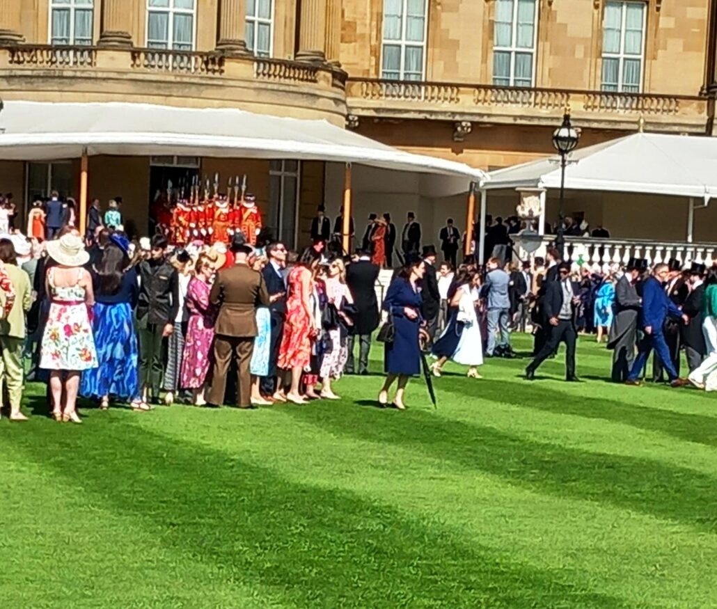
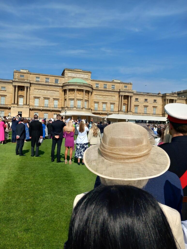
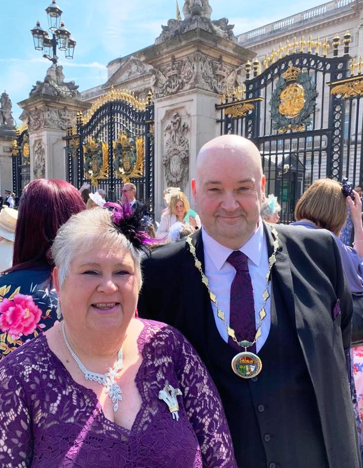
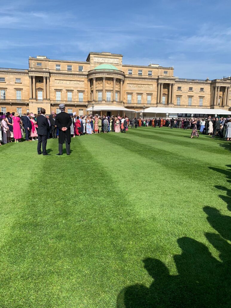
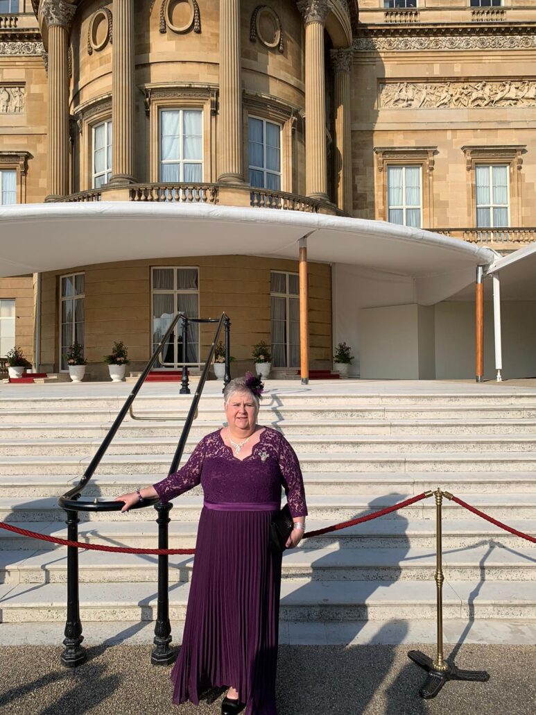
On Wednesday 9th May I as Chair of Resolven Community Council along with my wife, Joy, I had the honour of being invited to a Garden Party at Buckingham Palace.
It was an amazing experience and it was also a beautiful sunny day.
...
We were also lucky enough to be introduced to the King where he asked me which Community Council I was Chair of and that it must be a tough job to which I replied that it could be hard at times but it was a very rewarding experience helping the community. He said that a piece of his heart would forever be in Wales and to pass his regards onto the community in Resolven..
..
The picture attached of the gentleman in the kilt is the of “The Kings Piper” He was the person who played “The Last Lament” at Her Late Majesty’s funeral at St George’s Chapel, Windsor.
.
Joy and I both had a truly magical day which we will never forget.
https://resolvendistrictnews.co.uk/wp-content/uploads/2017/10/logo-1-300x41.png00Ed1https://resolvendistrictnews.co.uk/wp-content/uploads/2017/10/logo-1-300x41.pngEd12024-05-20 14:08:592024-05-20 14:08:59Congratulations to Councillor Neal Francis
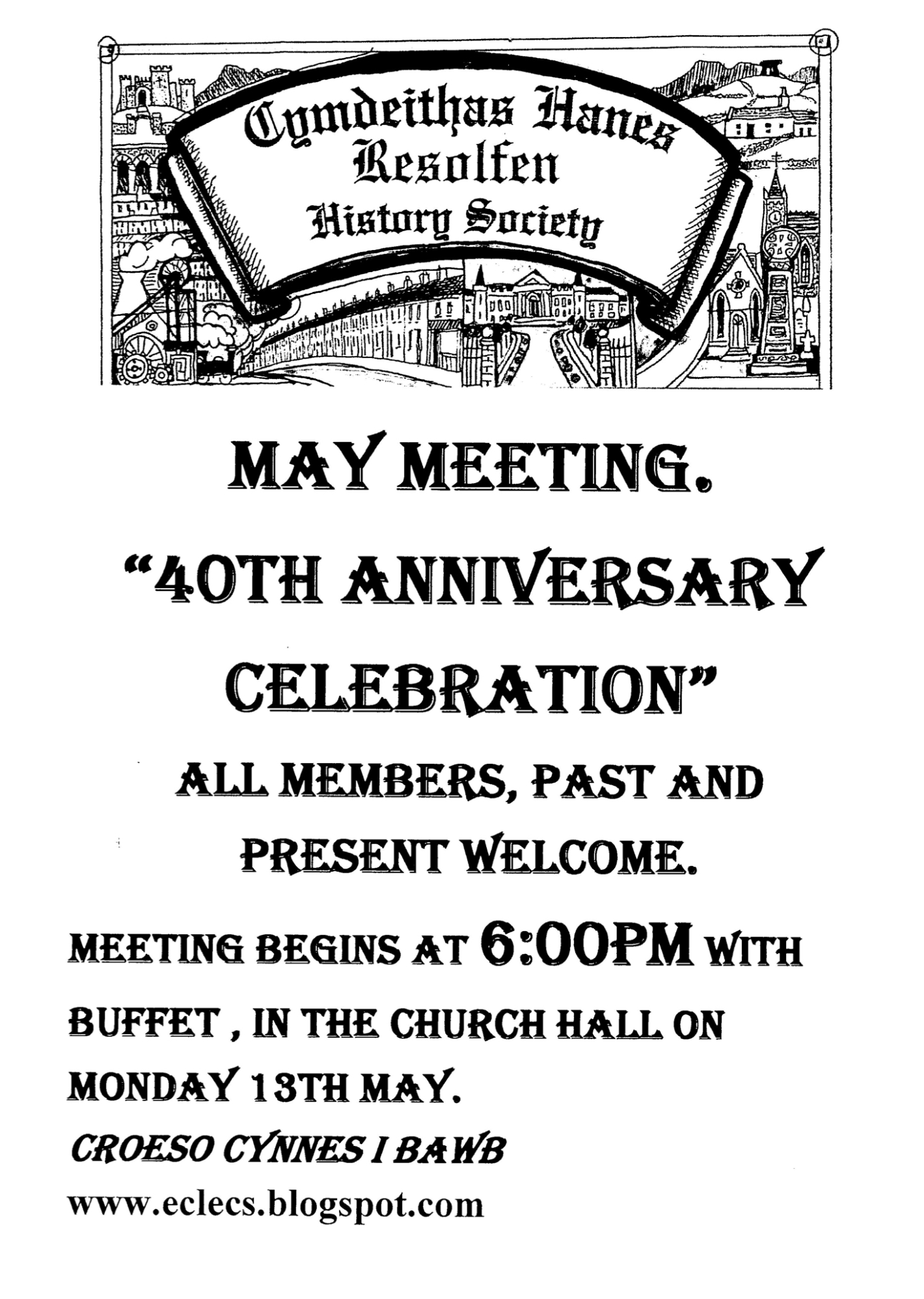
A Report on the 40th Anniversary Celebration of Resolfen History Society
Some 26 members and friends of the Society gathered at the Church hall to celebrate the milestone of having been in existence for over 40 years. Mrs Jane Llewelyn provided a sumptuous buffet for the occasion, which was enjoyed by one and all.
It was intended that the occasion would be an informal one and anecdotes were freely voiced of the history of the Society since October 1983. However, the formal aspect was not ignored and Mr Trefor Jones, read an extract from Resolfen Recalled which set out the early history of the Society and noted that at the turn of the Millennium the membership stood at 59 full members. He then took up the story of what had happened in the following 24 years. Firstly he paid tribute to the giants of the Society, in particular Phylip Jones who was the inspiration for its foundation in the first instance. He then pointed out some of the milestones, including memorial tablets to the Three Doctors of Music and to Professor Cliff Darby, who was and adviser to Churchill during the war. Reference was made to dinners, concerts, visits and treasure hunts held by the Society during the years. Reference was also made to the website which had received almost 250,000 visitors since its inception and included a digital modern history of the village via the work of Alun Morgan.
Turning to the more recent past, the Society had survived the pandemic with difficulty, and the road had been arduous in the past few years. However there were signs of recovery in the form of new members on both the committee and in general. Another welcome development had been the new found cooperation with sister organisations in the local area. In an age of instant satisfaction via Google it was important that original scholarship was given a platform in societies such as Cymdeithas Hanes Resolfen.
https://resolvendistrictnews.co.uk/wp-content/uploads/2017/10/logo-1-300x41.png00HL & LLhttps://resolvendistrictnews.co.uk/wp-content/uploads/2017/10/logo-1-300x41.pngHL & LL2024-05-16 16:15:232024-05-16 16:15:24Report on the 40th Anniversary Celebration of Resolfen History Society
Resolven residents were treated to a rare and spectacular display of the Northern Lights over the weekend. This stunning light show, the most intense in two decades, illuminated the night sky with vibrant hues of green, pink, and purple.
Photo’ taken from Vaughan Avenue looking towards the bowling green by @jack_walkaholic
The aurora borealis, typically visible in more northern latitudes, made a surprise appearance in South Wales due to a particularly strong geomagnetic storm. This rare event drew crowds of excited onlookers who braved the chilly night air to witness the celestial spectacle.
The unexpected appearance of the Northern Lights in Resolven serves as a reminder of the beauty and power of nature, and the importance of taking a moment to appreciate the wonders of the night sky.
A message from the Secretary for the Resolven Miners Welfare Scheme
Big News from the Resolven Miners Welfare!
We’re thrilled to share exciting progress on the restoration of our cherished old miners’ welfare building! This heart of our community is poised for a grand revival, promising to once again be a vibrant hub for all.
Restoration Updates:
Our dedicated trustees are in deep discussions about the building’s future. As insurance issues are being resolved, we are brainstorming potential business collaborations to breathe new life into this historic space. Imagine a revitalized centre buzzing with activities and opportunities!
Community Involvement:
We’re setting up a dynamic new volunteer group and eagerly seeking community members to join us. Got ideas or time to contribute? We’d love to hear from you!
Social Media Revolution:
Stay tuned as we transform our social media into a ‘community hub’. We’re planning a series of engaging posts starting May 13th to keep you informed and involved. Expect heart-warming stories, key updates, and perhaps even sneak peeks into the architectural plans!
Looking Ahead:
Meetings with funding bodies are already on the calendar. We’re committed to ensuring every penny is put to good use restoring the heart of Resolven.
Join Us:
Be part of this exciting journey. Together, we can turn the dream of reopening this historic site into reality. Let’s make history, Resolven! You can access read the full summary of our feasibility study along with viewing some drawings of what we have planned by visiting – https://resolvenwelfare.co.uk/feasibility-study-2/
Feel the excitement? Spread the word, and let’s make this project a shining example of what we can achieve together!
https://resolvendistrictnews.co.uk/wp-content/uploads/2017/10/logo-1-300x41.png00HL & LLhttps://resolvendistrictnews.co.uk/wp-content/uploads/2017/10/logo-1-300x41.pngHL & LL2024-05-02 06:14:422024-05-02 06:14:42Resolfen History Society May Meeting
A report on the April meeting of Resolfen History Society
The speaker this month needed no introduction since it was none other than Jeff Childs, erstwhile of Pontardawe who spoke on the legacy of steel and tinplate in the town, especially that of the Gilbertson’s work. This was Mr Childs’s sixteenth visit to the Society.
He began his illustrated talk by alluding to the famous people with association to Pontardawe, including Siân Phillips, Rachel Thomas, Gareth Edwards who went to the technical school and the Welsh poet Gwenallt. Even Glynneath boy, Max Boyce began his illustrious career above in the folk club situated at the Ivy Bush public house. None of this would have happened without the advent of heavy industry.
The catalyst for steel and tinplate was the Swansea canal built between 1796 and 98 , to Abercrâf. This alongside the building of the famous Edwards bridge, near the present day Pontardawe Inn, led to the land at Ynysderw farm being commandeered by the Herbert family of Cil-y-bebyll, for the building of a works. Indeed the main road in Pontardawe to this day is Herbert Street. The original entrepreneur was Richard Parsons, who built ultimately and industrial complex including a steel, tinplate and sheet steel works. A chemical works not owned by Parsons supplied vitriol for Galvanising. The Gilbertson family then dominated the enterprise for many decades, leaving a legacy in St Peter’s Church which today still dominates the skyline with its 197’ spire. William Gilbertson indeed was responsible for the beginnings of steelmaking at the Abbey works in Port Talbot, though he quickly returned to Pontardawe. The Gilbertson’s intermarried with the Gwyn family and indeed fourteen children issued from William’s marriage.
Following the death of William Gilbertson from a stroke in 1912, the plant was managed by three of the Gilbertson brothers, as the plant was gradually taken over by other interests including RTB , and the Steel Company of Wales in the early 1950s. Indeed by 1958 the works was slowly closing and the land was being redeveloped, closing ultimately in 1962, with the trademark chimneys demolished in 1965. Today the site is marked, by the site of Cwmtawe School, the Alloy trading estate, a sports centre, a Lidl store and an old peoples’ complex which is being redeveloped from the old administrative block to the best environmental specifications. Some walls still contain the old waste sheets of steel as a reminder of a previous age.
In concluding his talk, Mr Childs made reference to the well-known story that the roof of the White House and especially the West Wing was manufactured in Pontardawe. This is partially true, in that a former roof was manufactured by Gilbertsons, however this predated the building of a west wing to the building, so 80% correct. The present White House has an entirely new roof.
Mr Trefor Jones, thanked Mr Childs for a memorable talk, and hoped that he would add to his tally of visits.
~ ~
Next month the Society will finish the year with a social evening to mark its 40th anniversary. The event will take the form of an informal tea, starting at 6 o’clock and all members past and present are invited to share some memories of the Society. See you all on Monday, May 13th!!!!
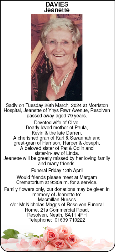
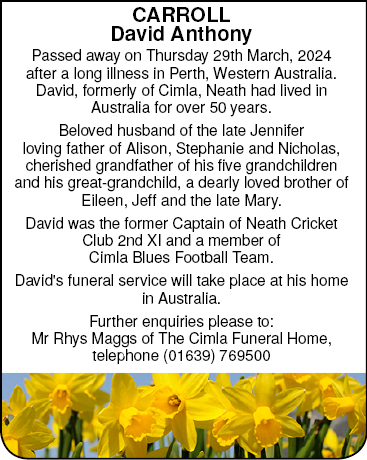
https://resolvendistrictnews.co.uk/wp-content/uploads/2017/10/logo-1-300x41.png00Ed1https://resolvendistrictnews.co.uk/wp-content/uploads/2017/10/logo-1-300x41.pngEd12024-04-03 08:59:242024-04-03 08:59:24Funeral Notice for Mr David Carroll
https://resolvendistrictnews.co.uk/wp-content/uploads/2017/10/logo-1-300x41.png00HL & LLhttps://resolvendistrictnews.co.uk/wp-content/uploads/2017/10/logo-1-300x41.pngHL & LL2024-03-20 15:05:192024-03-20 15:06:08April meeting of The Resolven History Society
This was sixth occasion that Huw Williams of Merthyr had spoken to the Society, and despite the long break during the pandemic he had lost none of his enthusiasm and indeed his humour. He noticed that numbers were down on past years , however he maintained that the Society was doing well in comparison with other major societies which had crashed in recent years in the Cynon and Merthyr areas.
Mr Williams took as his broad canvas, which included recruitment for an imagined film, that Resolven stood on an apex historically between three varieties of Wales. To the west was traditional Welsh Wales, steeped in the Welsh language and chapel culture. To the east were the more anglicised valleys and to the south the “Americanised” coast. This was highlighted by the traditions of the anthracite and steam coal areas with their waves of migration coming from different directions, both to avoid the penury of agriculture in Carmarthen as against the Forest of Dean and Herefordshire. After all, a collier could earn more in a few weeks than a year as a tenant farmer, ensuring his diet of salted butter, cheese and fatty bacon. This was illustrated by comparing Resolven resident B.L. Coombes who had moved from rural Herefordshire to “Aberclwyd”, when he met the hymnal of Pantycelyn. This was captured in his book “These Poor hands”, and “Miner’s Day”.
The technological revolution in the valleys epitomised in the Railway age, saw Brunel’s Vale of Neath Railway carry coal to Swansea, usurping the monopoly of the Butes in east Wales. Similarly David Davies of Llandinam, had exported more coal through Barry Docks which fuelled the sea traffic of world trade. This was epitomised by Chaplin’s “Modern Times”, film.
~
Mr David Woosnam, thanked Mr Williams for a brilliant talk, and hoped he would speak on north versus south next year.
https://resolvendistrictnews.co.uk/wp-content/uploads/2017/10/logo-1-300x41.png00HL & LLhttps://resolvendistrictnews.co.uk/wp-content/uploads/2017/10/logo-1-300x41.pngHL & LL2024-03-12 11:01:292024-03-12 11:01:29Resolven History Society Report on the March Meeting
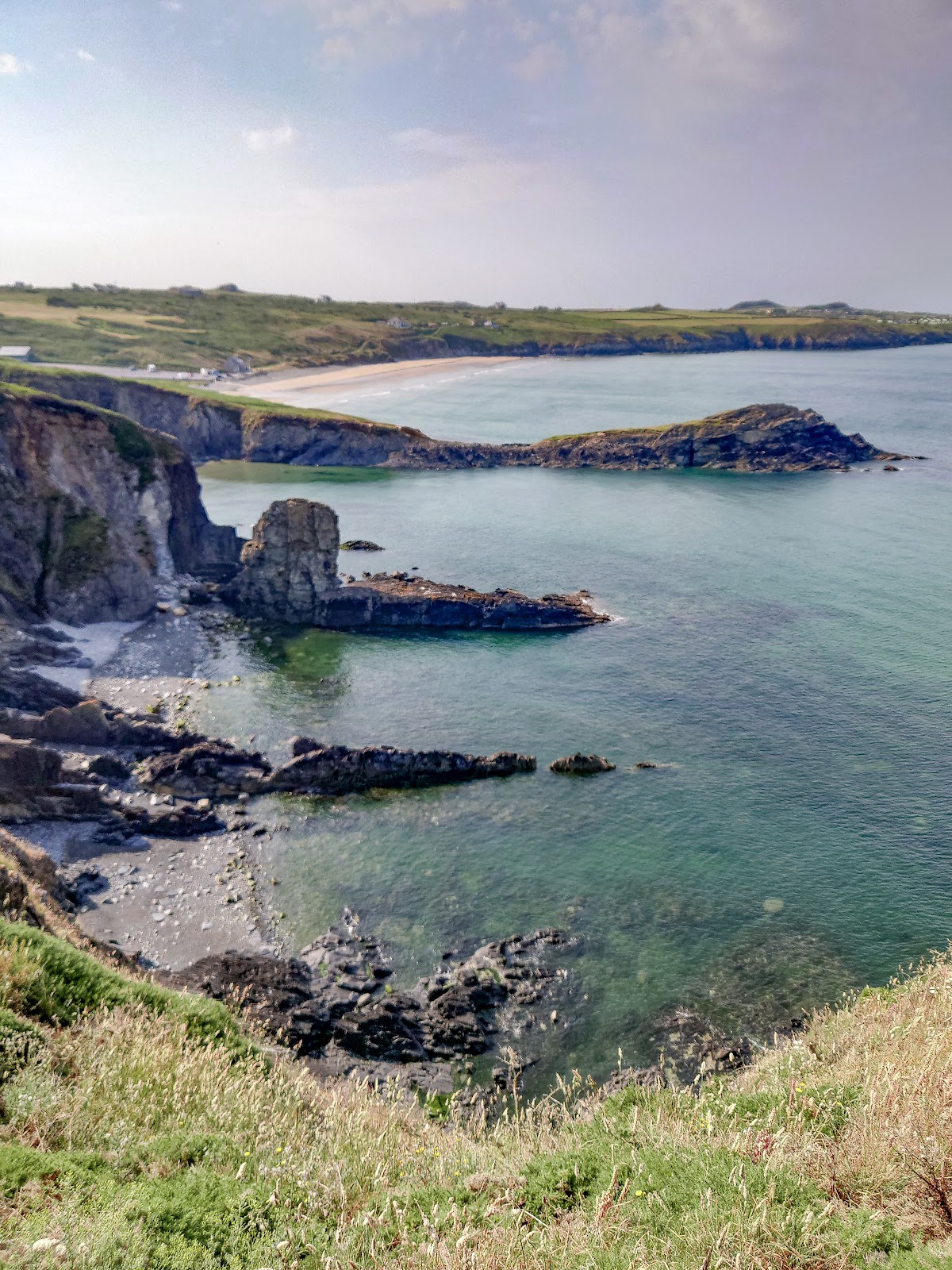
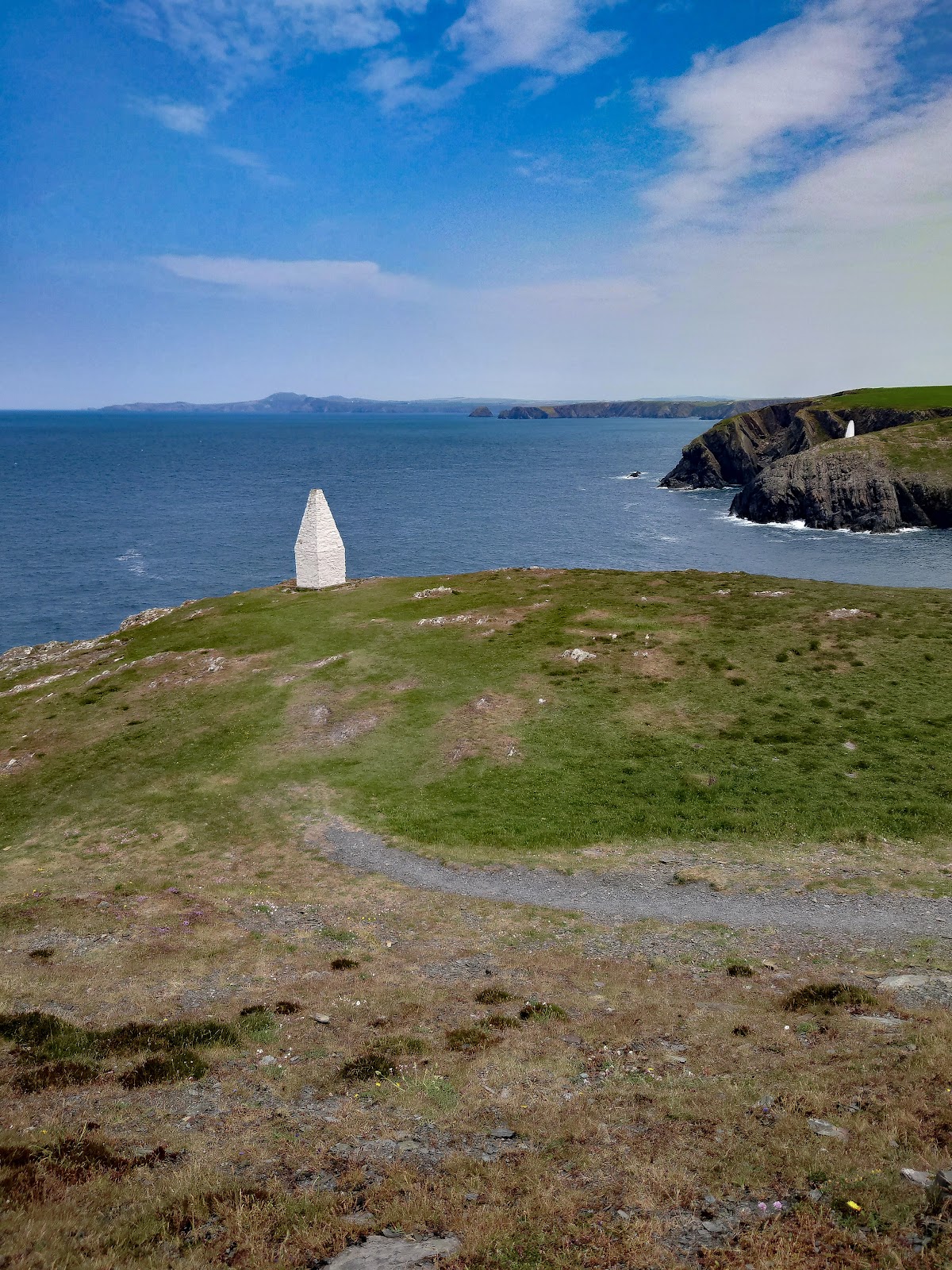
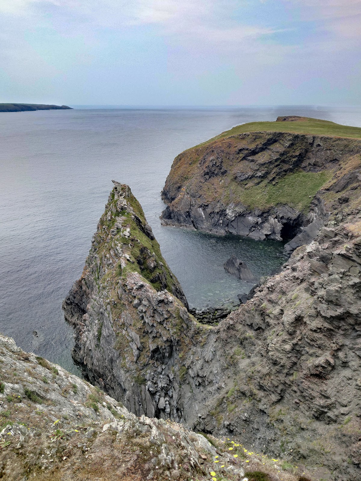
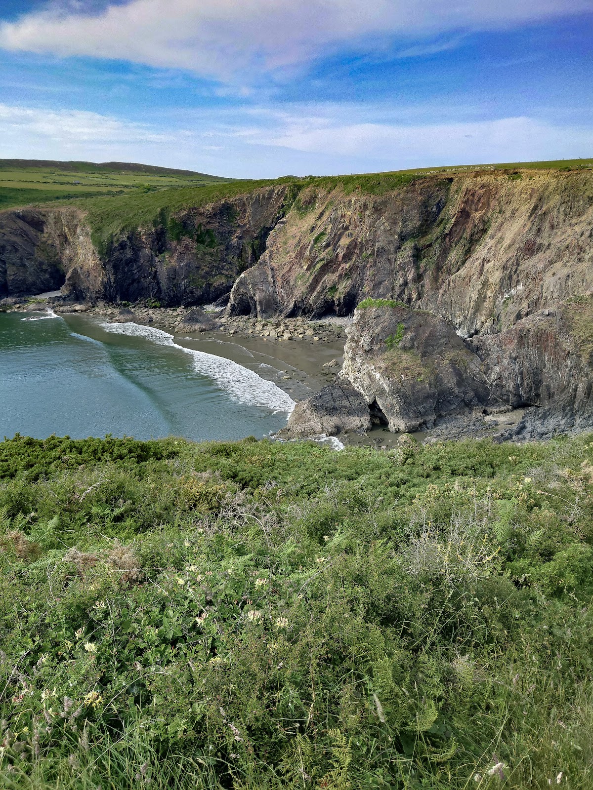
The June sun, already setting records for the hottest, blazed down on my back as I crunched over the rocky coast path. Whitesands Bay stretched behind me, a turquoise jewel framed by golden cliffs. Not a bad view, all things considered, especially considering the disaster that was to become today’s walk.
It started perfectly. Birdsong filled the air, the scent of wildflowers drifted on the breeze, and the map app on my phone, accurate as always. Then, right after passing those ancient hut circles, it went kaput. No map, no internet, just me and the increasingly confusing waymarkers.
.
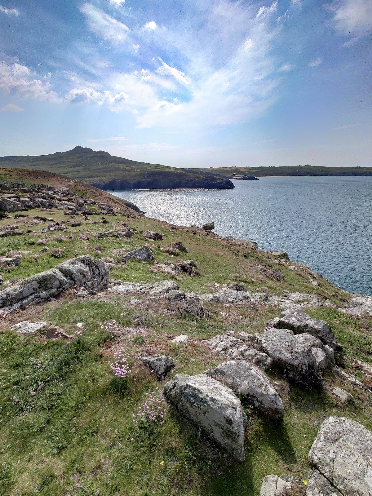
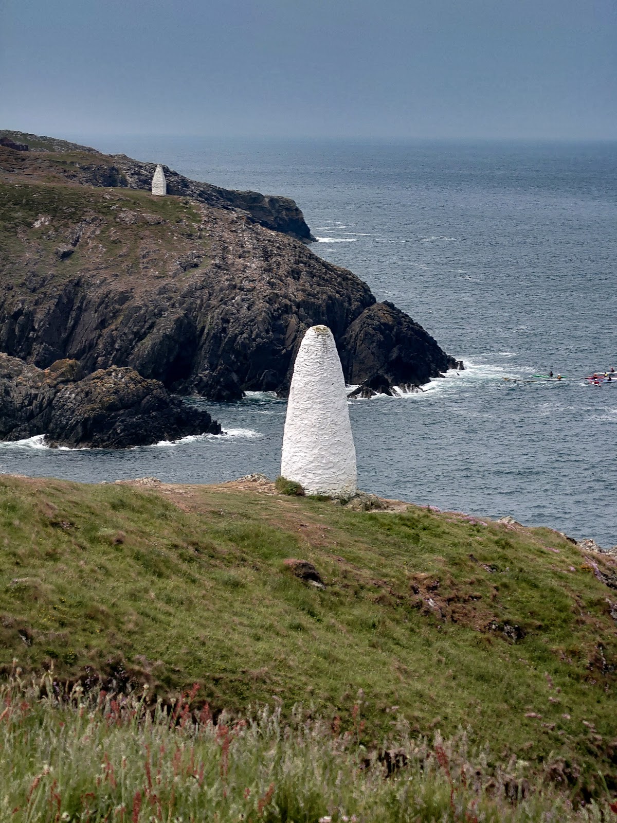
Abereiddi Bay, with it’s impossibly blue lagoon and cliff-jumping crowd, was a welcome mirage. But where were the usual vendors? No ice cream van, no burger bar, just an empty car park. The thirst settled in, a dry whisper at first, then a persistent hum. My map app decided to behave itself again, what else could go wrong?
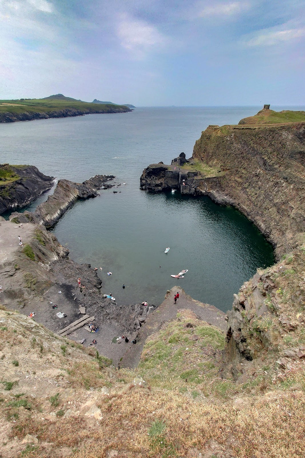
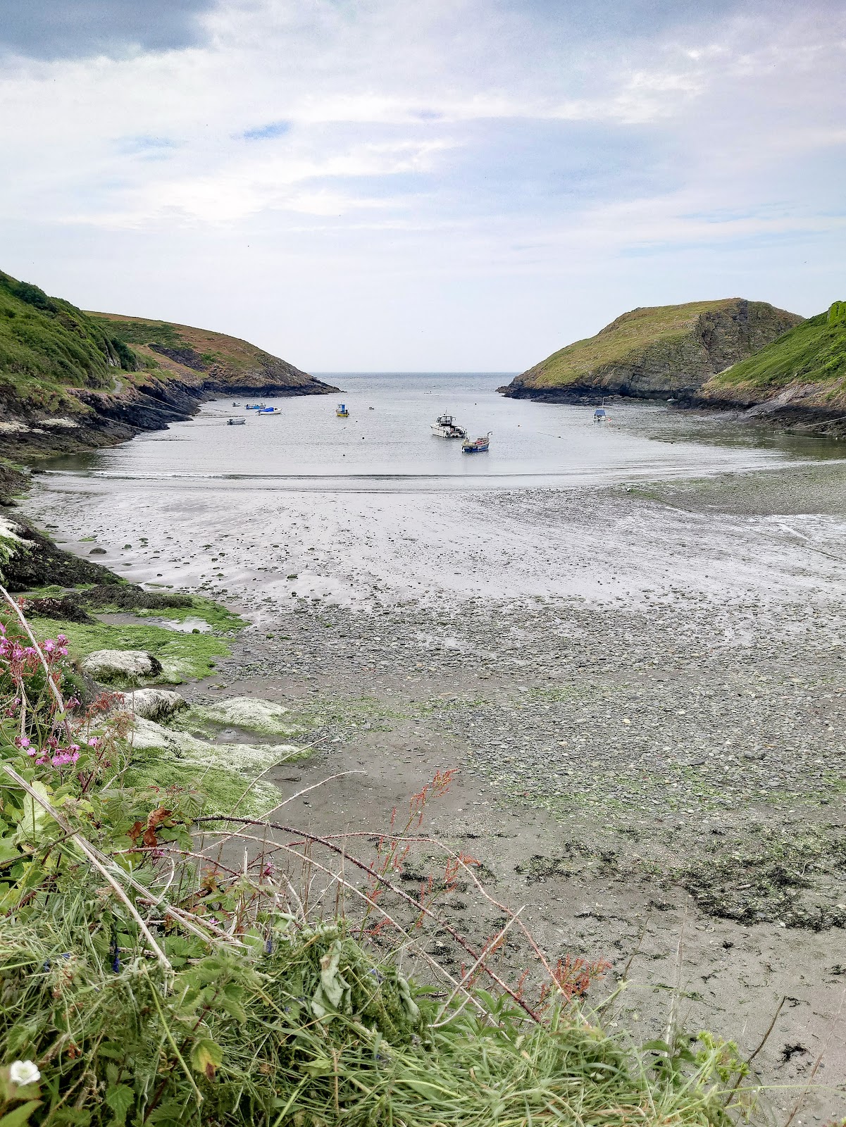
Pushing on, Porthgain offered more history than hydration.
.
Slate quarries scarred the cliffs, a ruin that was a loading factory, remnants of an industrial past, while the ruined Trefin Mill whispered tales of bygone toil.
Each cove brought a fresh hope for a shop, a cafe, anything with a liquid refreshment.
Porth this, Porth that, they blurred into a thirsty symphony of P-words.
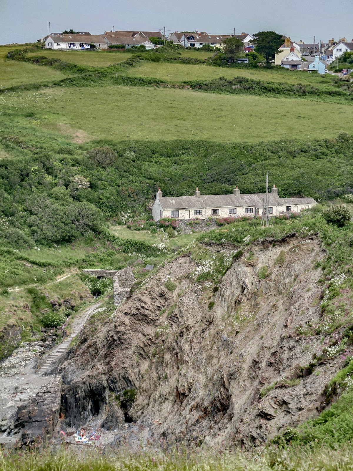
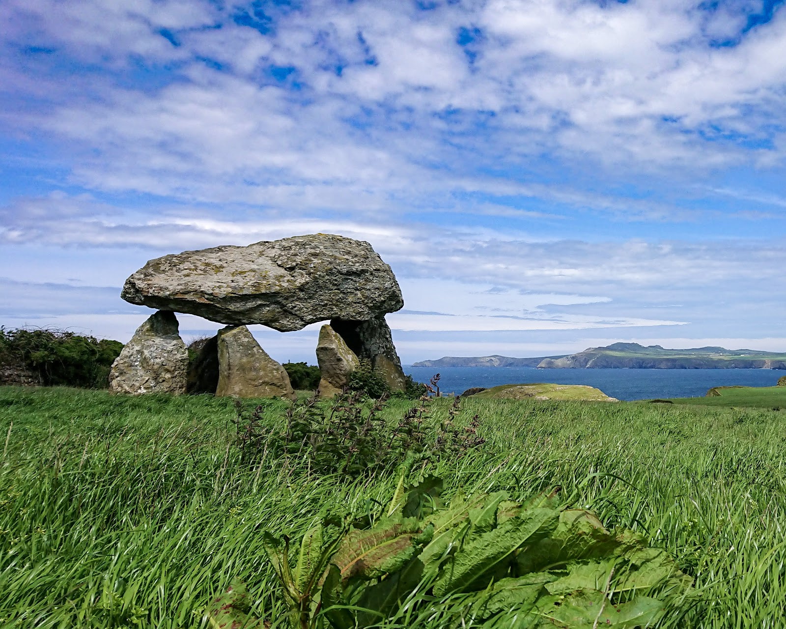
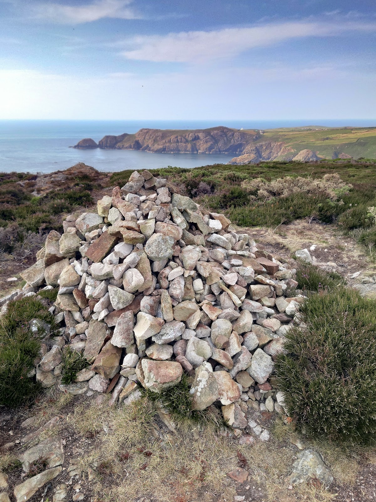
Eventually, Abercastle, a tiny fishing village hidden in a cove, with it’s impressive burial chamber, “Carreg Sampson”.
It seemed to hold a promise of a can of pop, but nothing.
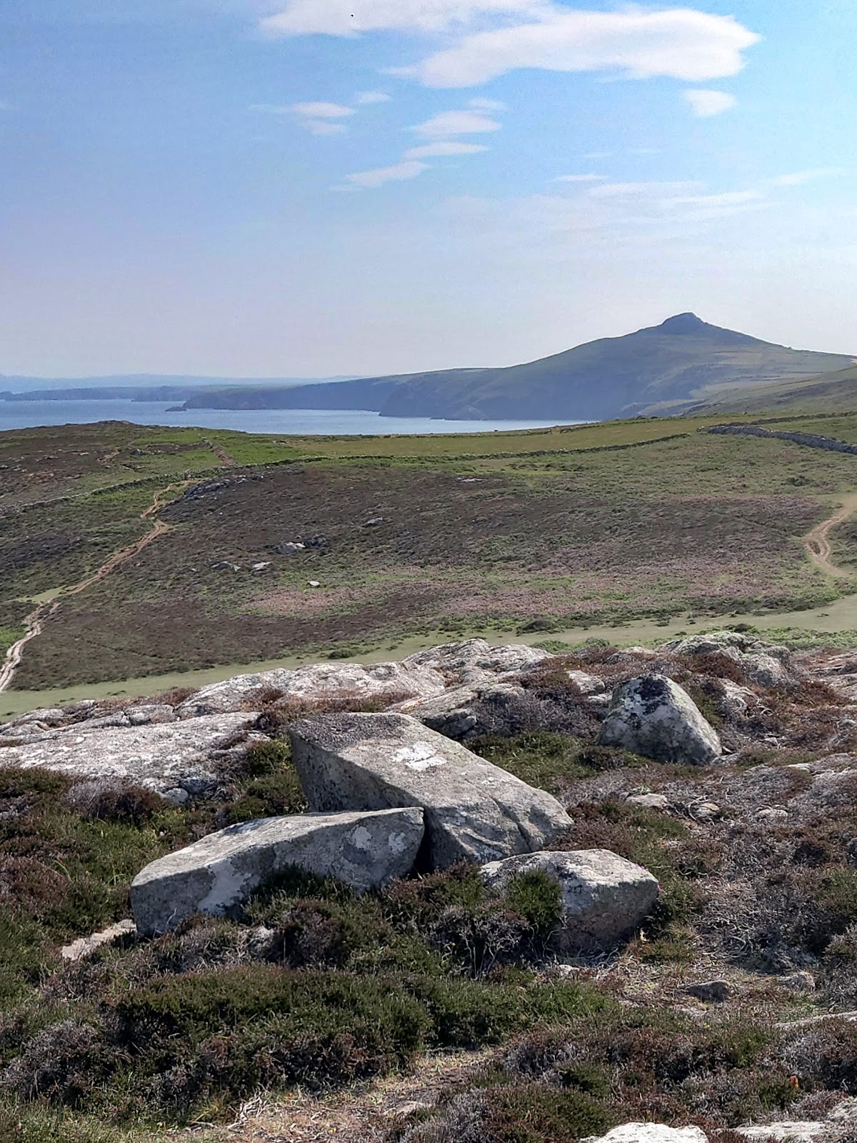
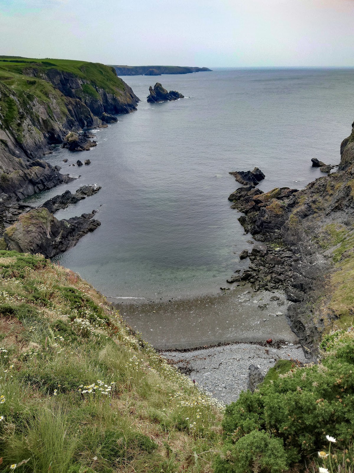
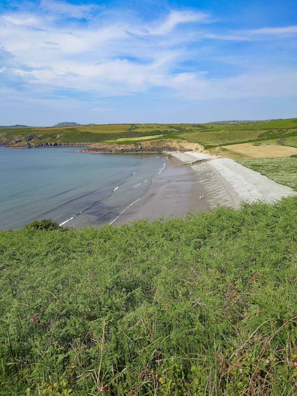
By the time I reached Abermawr and Aberbach, the late afternoon sun cast long shadows and my tongue felt like sandpaper. Three villages, countless coves, and not a single sip.
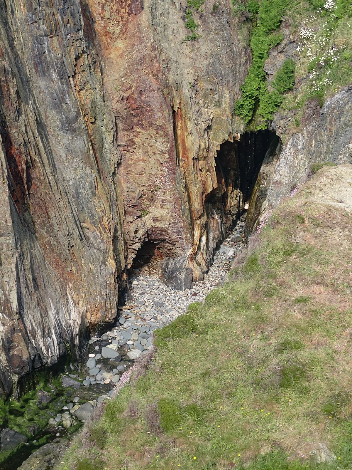
The geology lesson at Pwllcrochan, with it’s mind-bending rock formations, did little to quench my thirst.
.
My legs, too, were starting to complain, each step a protest against the heat and the empty void in my stomach. Pwll Deri, Porth Maen Melyn, the names blurred past like silent pleas for water. You know it’s getting late when the moths start coming out.
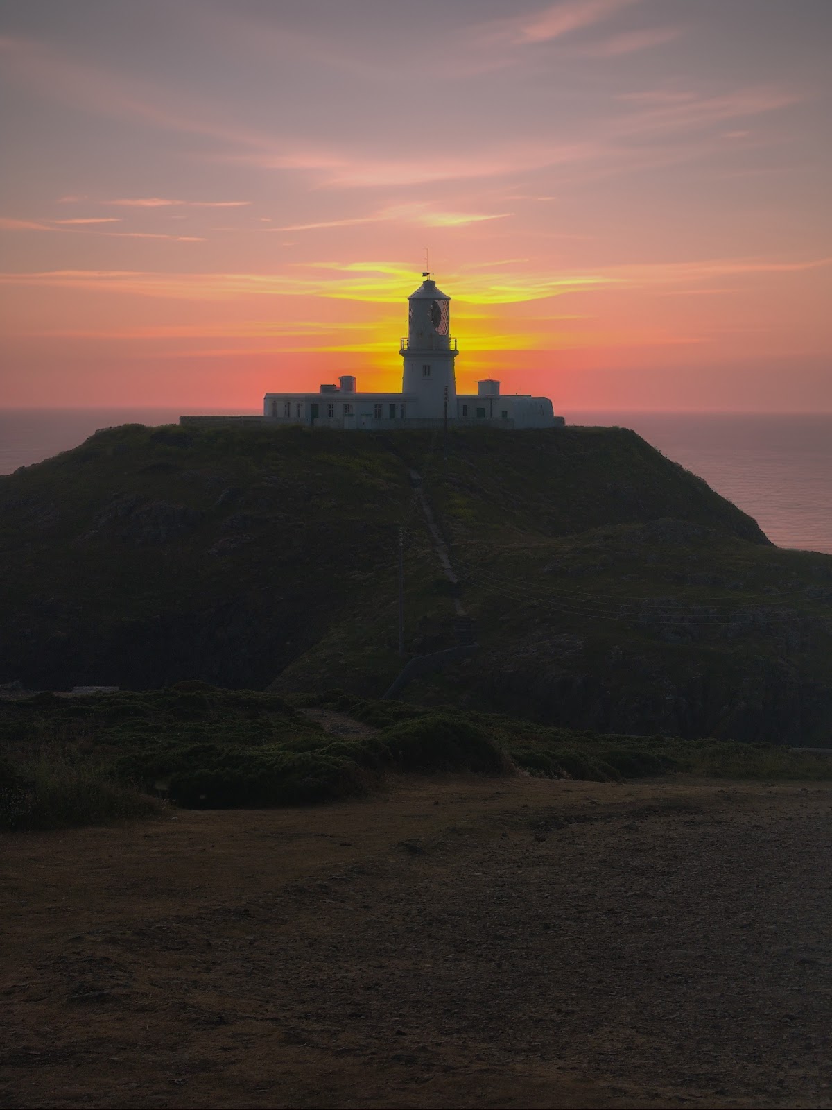
And then, in the distance, a blink of salvation – Strumble Head Lighthouse, its white walls glowing in the sunset. Half an hour, that’s all it was. I practically ran, spurred on by the promise of liquid redemption.
Reaching the car, I guzzled down two litres like a man possessed, the cool water flooding every parched cell.
I’d had enough this day, but still had to drive home, just to finish my day off nicely, the M4 was closed from Pontarddulais, the diversion went into Llanelli.
~
Until the next time
~~
If you wish to see more on RDN by this contributor, search Jack_Walkaholic above.