Jack_Walkaholic in South Pembrokeshire
Part 2
We Continue with the next instalment (around South Pembrokeshire) from Jack_Walkaholic as he resumes his journey to complete the wonderfully scenic walk around the Coast Path of Wales.
~ ~
I look at the map of Wales and don’t realise how big Pembrokeshire is; it’s the same distance around as from Chepstow to Kidwelly. You can see the story so far on previous posts on Resolven District News, or if you want to see the whole story you can find me on Instagram @jack_walkaholic.

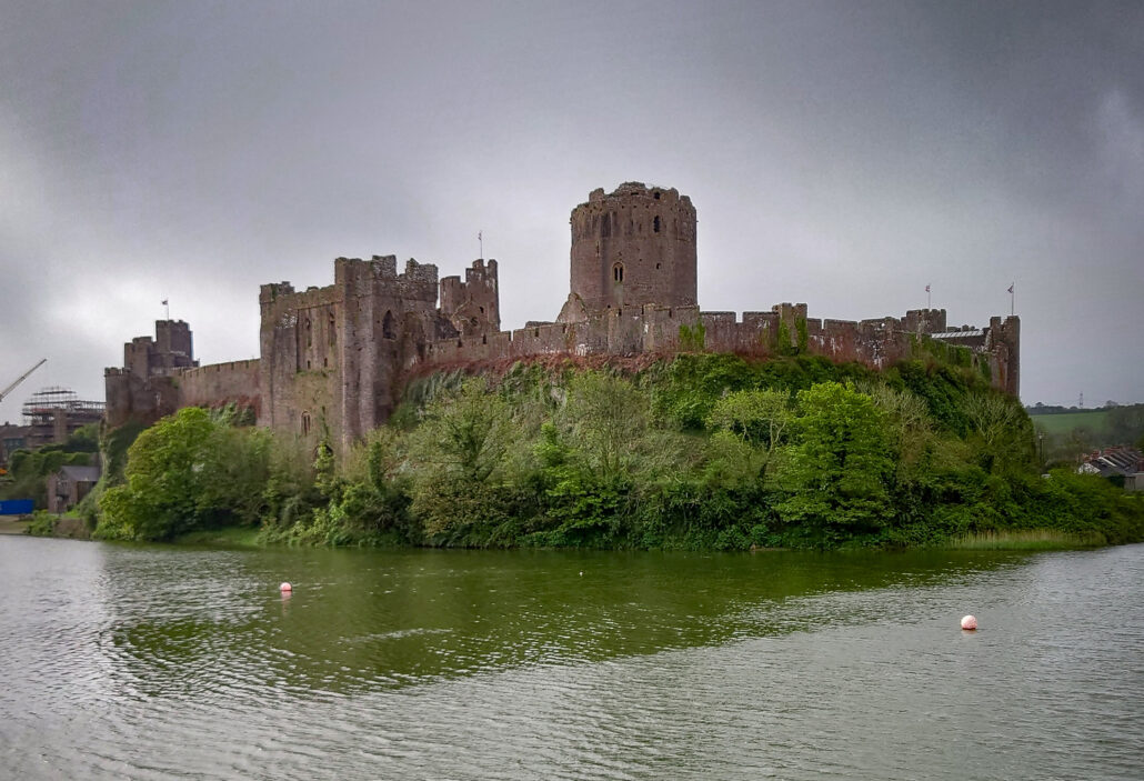
Starting at Pembroke Castle, I go around the moat and into a woodland, heading towards Pembroke Dock. The path weaves its way through the streets of Pembroke Dock, and ends up overlooking the estuary and Neyland Bridge. I hear on the radio that Neyland Bridge is closed due to high winds and as I look at it, I can see why it would be a problem for high-sided vehicles. This is the crossing point that I’m heading for as the path takes a blustery step across the bridge.
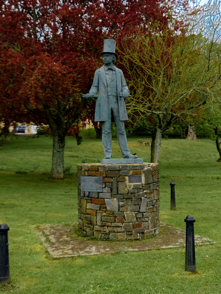
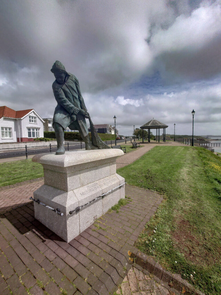
Neyland is one of those places that I’ve never been to. I’m impressed by the bridge viewpoint and the Brunel Park. Out of Neyland and around another oil refinery. Before I know it, I’m in Milford Haven. The name Milford Haven conjures up a picture of the oil refinery and docks in my head. I’m surprised to see a Georgian promenade and a bustling town centre. It doesn’t have a sandy beach, and I think that’s what holds it back from being a big tourist town.
Goodbye Milford Haven, hello another oil refinery. This is the most industrialised part of the path. It takes you through caged bridges and under pipelines. All of a sudden the path turns and you’re facing away from the waterway. It’s a different world. I didn’t realise how tense it had felt walking around this metal monument, with no people, just machines and ships constantly buzzing and moving things. You turn and it drifts away, all that tension is gone.
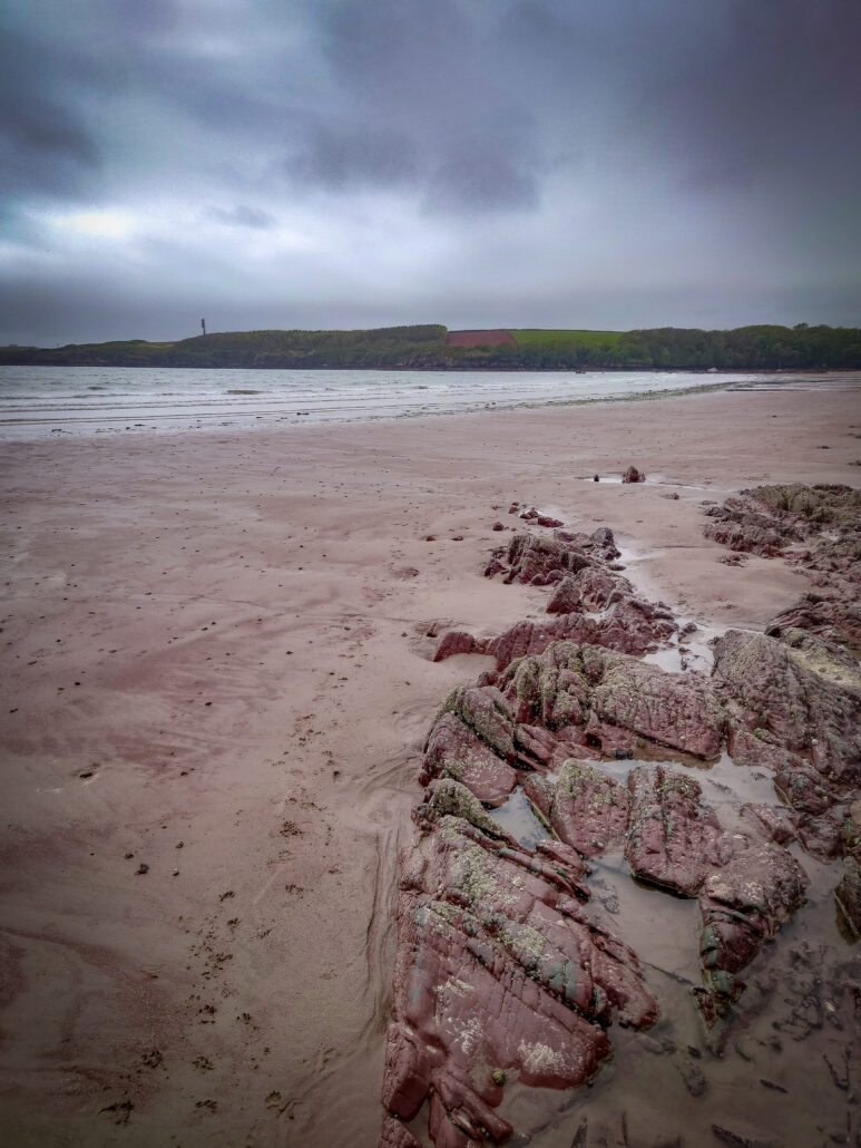
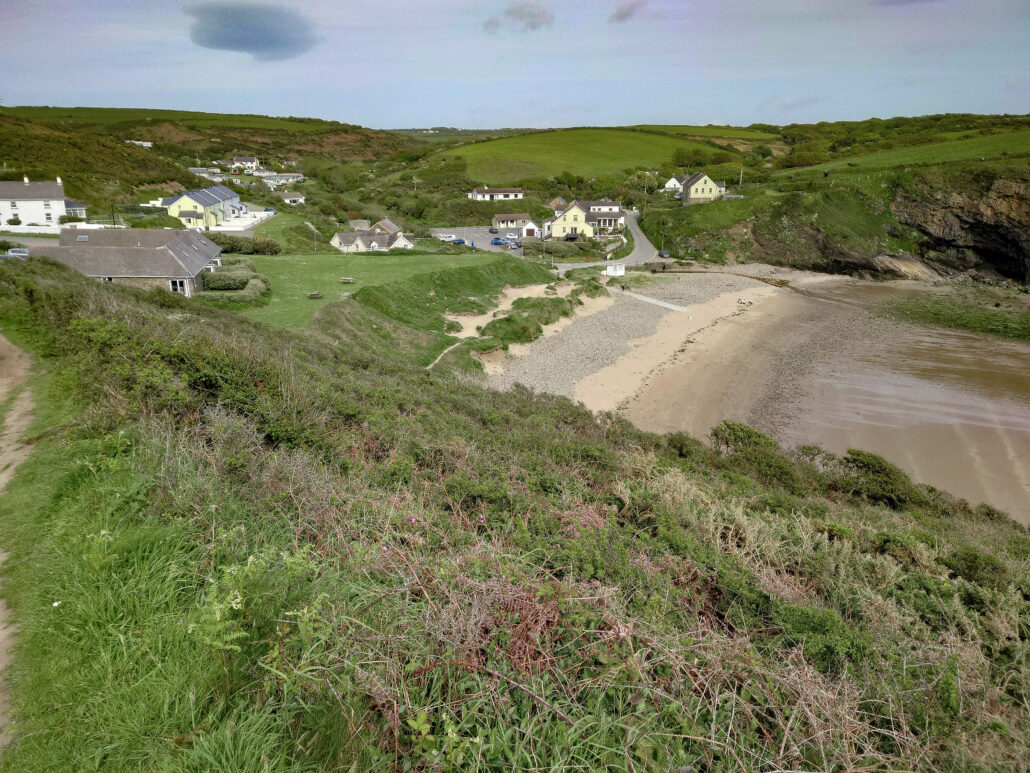
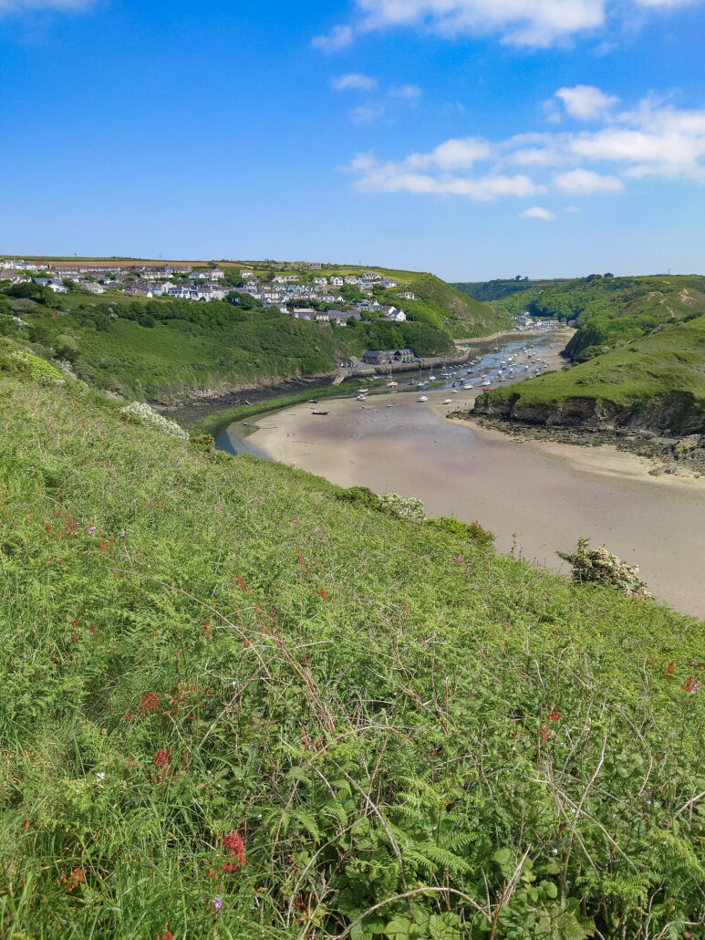
Just when you think it couldn’t get any better, a nice sandy beach. This one is called Sandy Haven and is a well-kept secret. The road to this beach is overgrown and has a small car park, so the locals want to keep its location secret. This is my endpoint for the day, so I sit and watch the tide for a while.
~
There’s a set of stepping stones at Sandy Haven. They’re only available for three hours either side of low tide. If you don’t time it right, there’s an extra four-mile walk around the estuary. Luckily, I timed it right (only just).

This was a beautiful day. The sun was beating down and a lot of the next few miles were on clifftops and open fields. The next village has a river crossing. This is a wooden gangway. The gangway is broken, but as the tide was low, and encouraged by a local fisherman, I decided to jump from one side to the other. I got wet! Here I found my first ever piece of sea glass in Dale.
Apparently, there’s a lot of it here. Along the road and into Dale. Dale is a water sports hotspot. Any type of water sport you can think of goes on here. The place is busy with people preparing to take to the water.
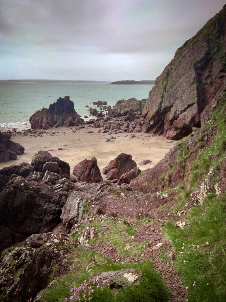
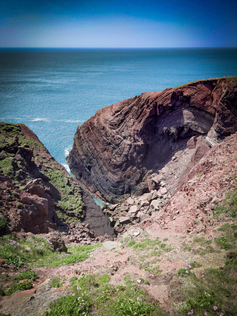
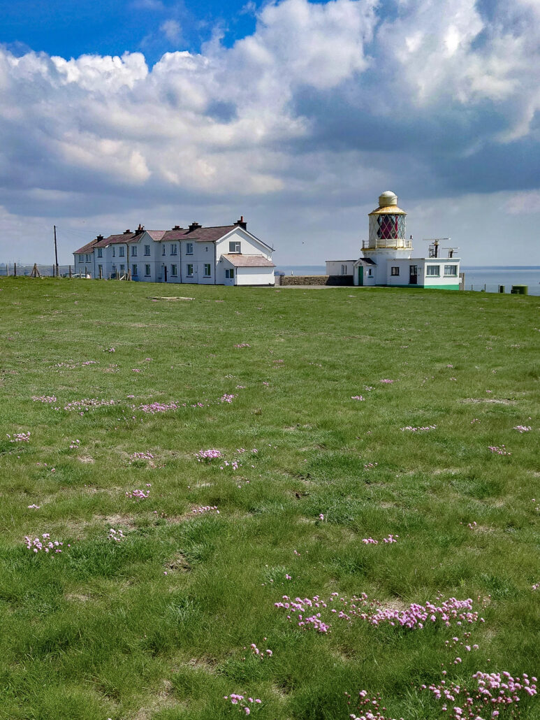
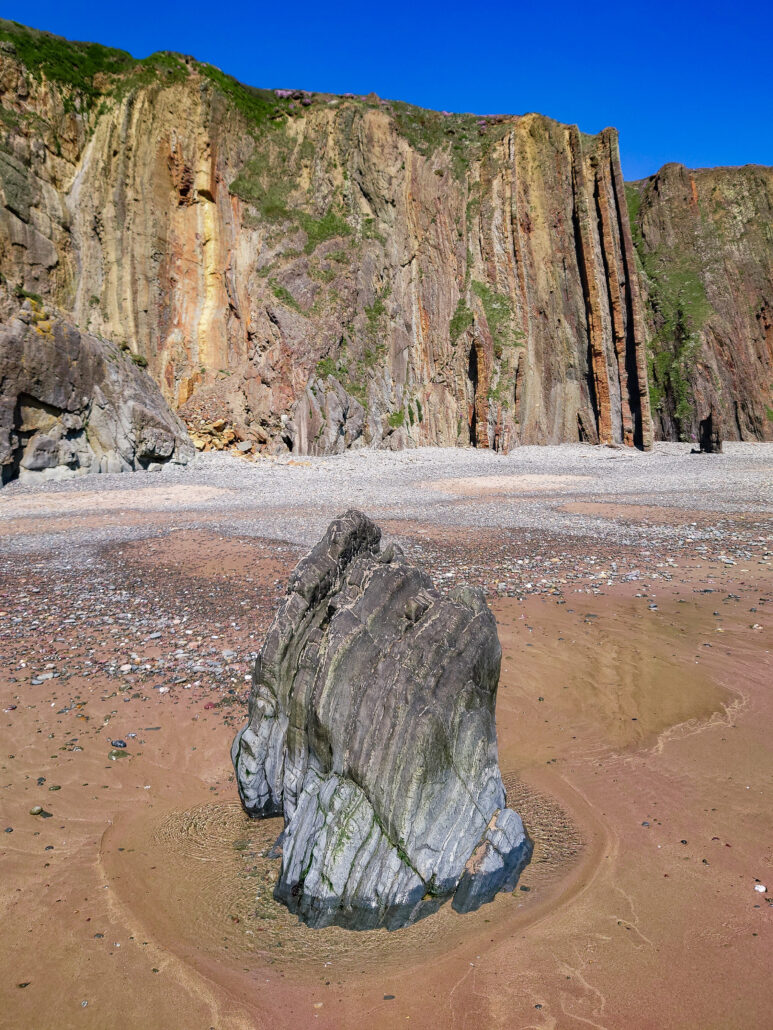
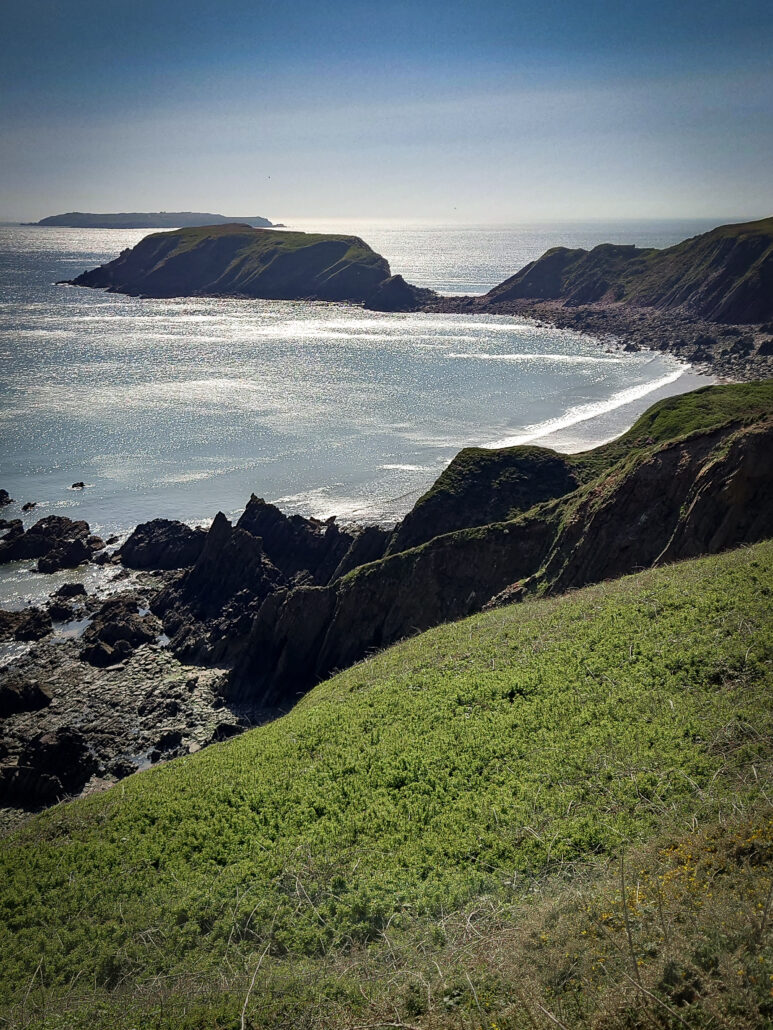
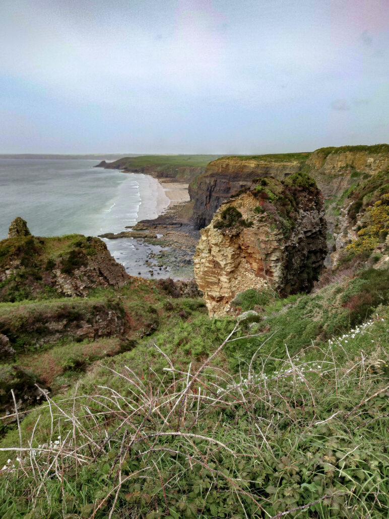
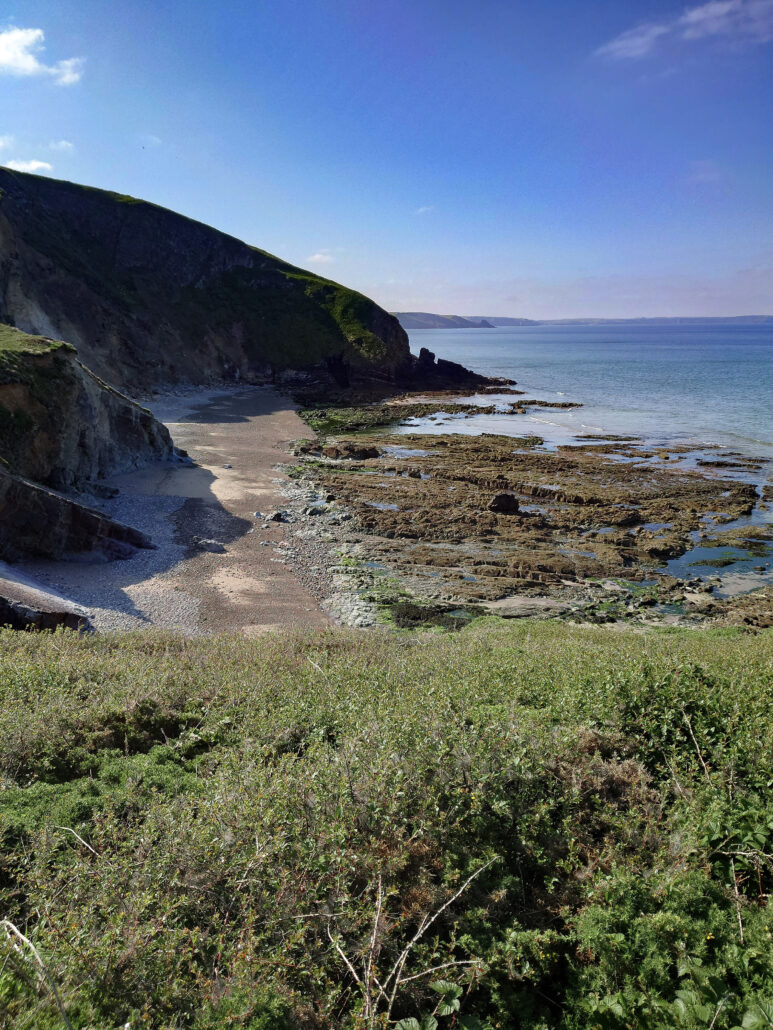
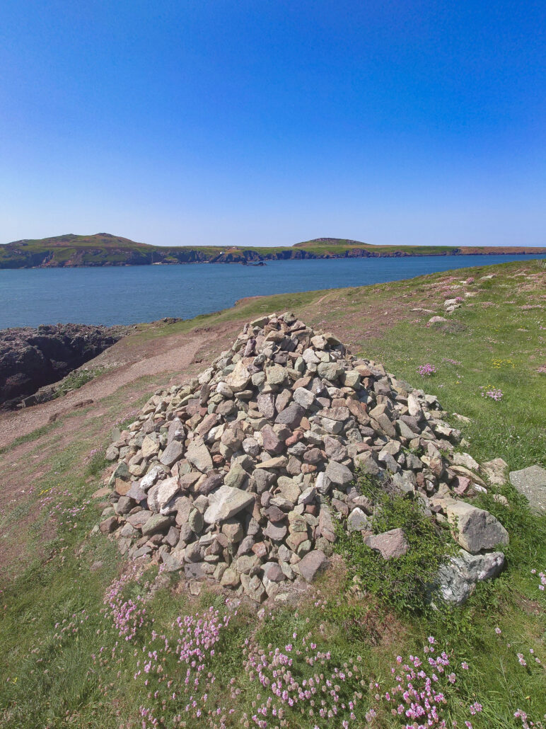
I quickly leave, back to the fields, cliffs and cows. I’m plodding towards Saint Ann’s Head. The geology is what makes Pembrokeshire Coast a National Park. There are so many textbook faults, folds, and fractures along the way. Not too far from the lighthouse at Saint Ann’s is a lovely formation.
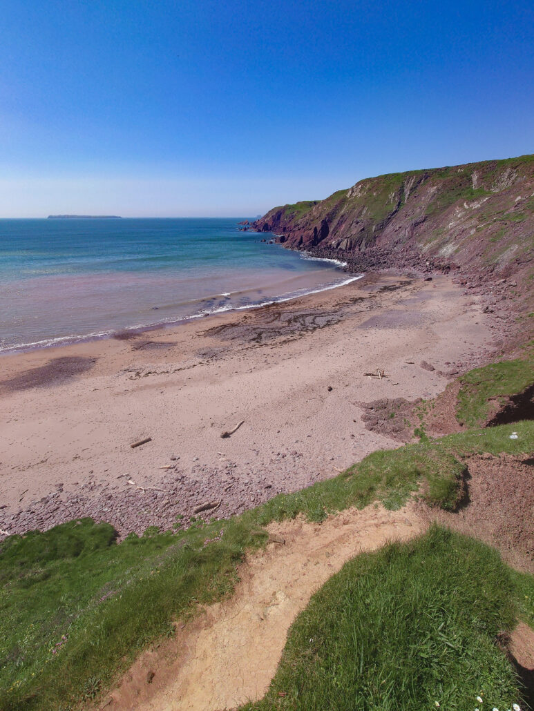
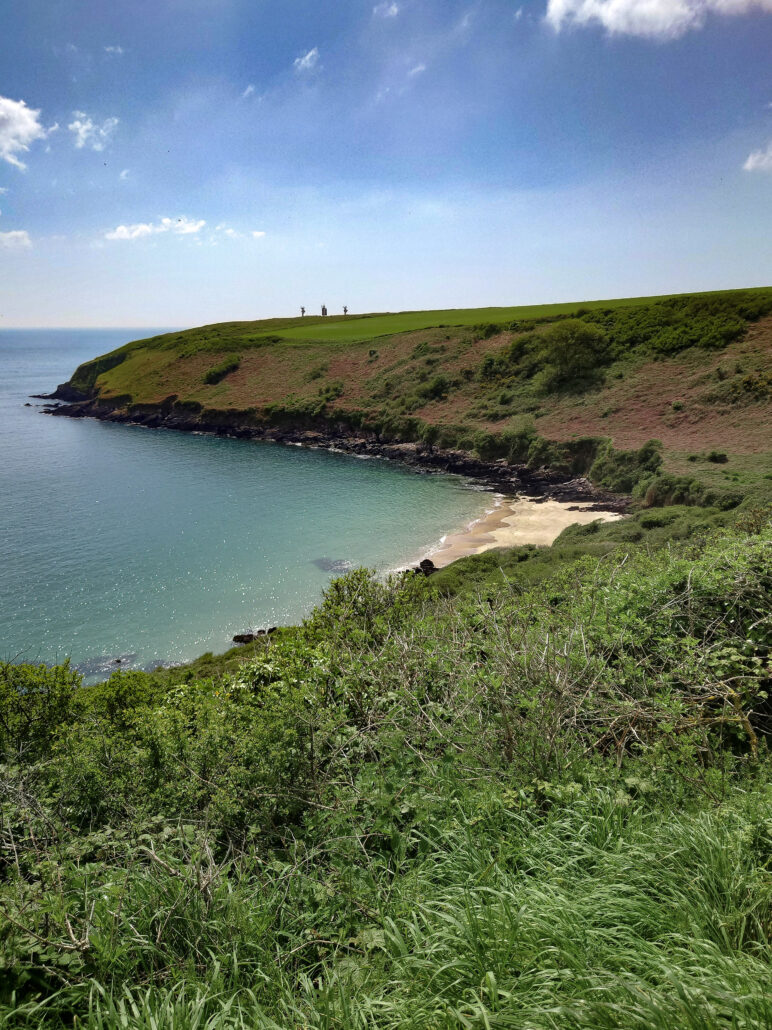
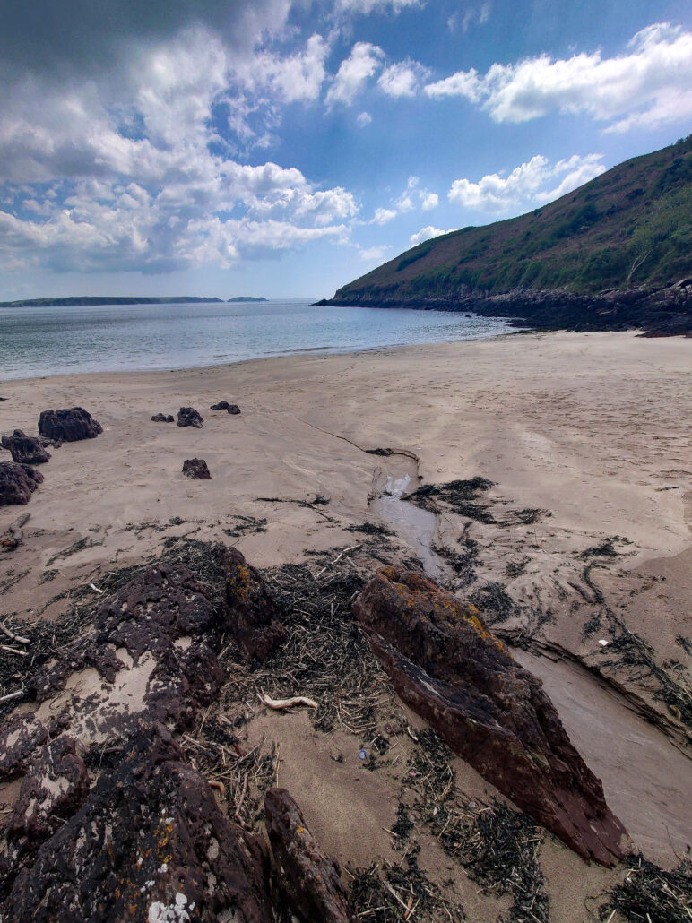
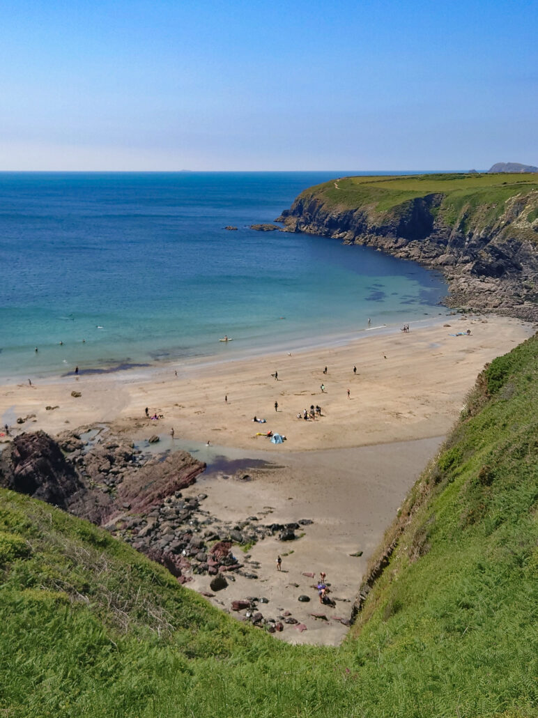
Onward. Did you know Dale has a second beach? This one is called West Dale Bay and has big waves coming straight off the Atlantic onto its golden sand and red rock. A little further along, past the remains of an airfield, I see the view that I’ve seen on many Wales calendars: Marloes Sands. This is a postcard beach, with a beautiful long, light golden sand, huge waves, some unique geological features, and a blue sky.
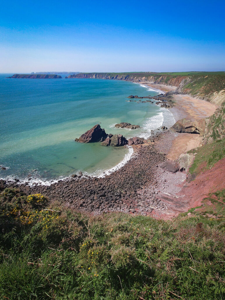
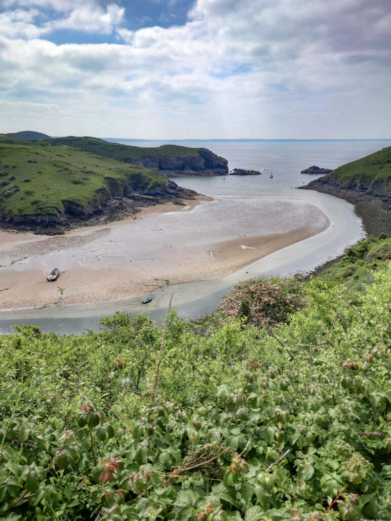
With a tear in my eye, I have to leave. Around the Raggle Rocks, I pass by Gateholm Island and Rainy Rocks. My destination for this day is Martin’s Haven, most famous for being the place to get a boat to Skomer Island to see the puffins. The two days I was in the area, the sun was out and it was a hot day, but the boats weren’t running.
Another day dawns and I just have one bay to walk around: Saint Brides Bay. Starting at Martin’s Haven, I head north up the coast. The geology in this part is diverse. For a while, I’ve noticed the rock colour. It’s a red colour that I associate with Pembrokeshire, but at Musselwick Sands, it changes to a black rock. I continue to St Brides Haven, a small haven with a big house that is now a luxury hotel. It looks fantastic. Before I know it, I’m in Little Haven. From Little Haven to Broad Haven, I stay on the beach and admire the caves in the rock face.

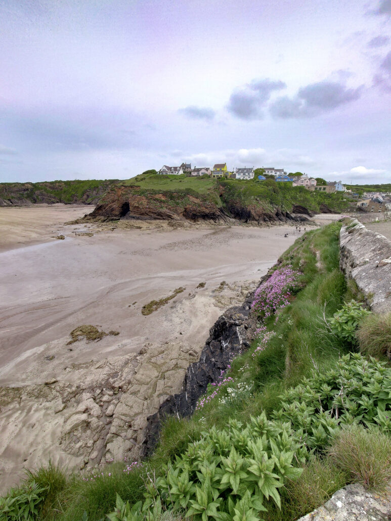
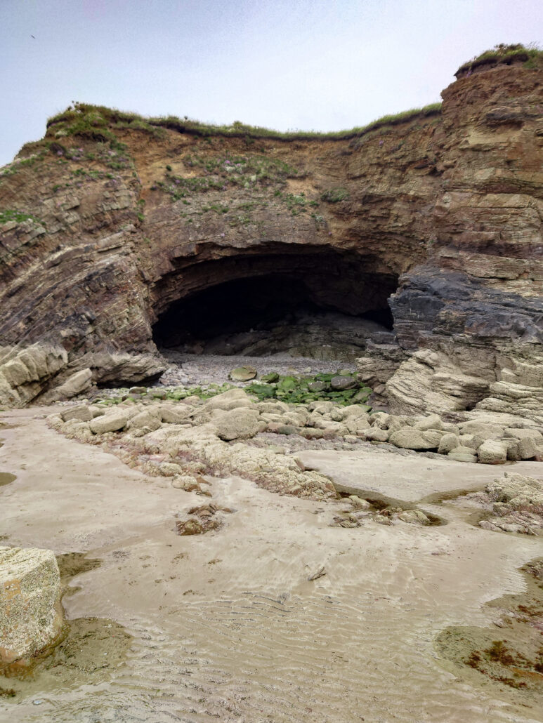
From Broad Haven, Druidston Haven is a short skip away. This is an impressive beach with steep cliffs all around and just one access point. Caves in the rocks make me think that pirates were active in this area, with plenty of places to hide their loot.
Norton Haven is the next stop. There are a lot of havens around here. It’s a sweet, quiet place sandwiched between the two larger and better known tourist spots of Broad Haven and Newgale.
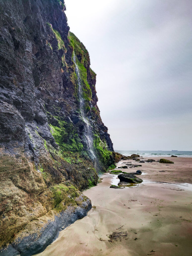
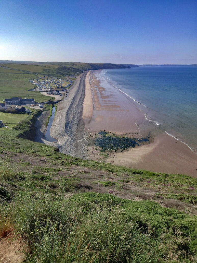
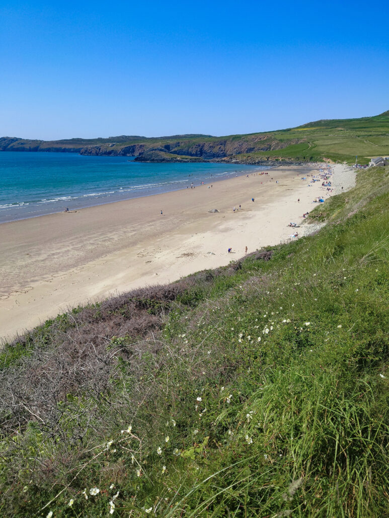
Newgale is a camper’s dream. In the summer, the campsite is crammed with tents, caravans, and mobile homes. The campsite is on one side of the road and the beach on the other. It’s a good long beach, with big waves, popular with surfers and anyone who loves the water or sand.
As it has a good car park, I finish my day at Newgale and return a week later to continue. On both days, the tide was in, the sun was out, and the beach looked amazing. There are a few small coves and rocks along the way, but the next main place is Solva. This beautiful harbour is sheltered from the sea by a headland that curves in, so it doesn’t receive the full force of the open sea. It’s a popular tourist hotspot. Many people come to see the harbour and there’s a cafe on the quay that I have to fight my way through the crowds to pass.
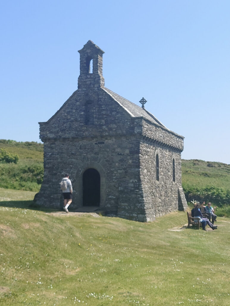
Pushing on, I come to Saint Non’s chapel. This chapel was built on the place where Saint David was born. On that day, there was a great storm everywhere, except here where the sun beamed through the clouds. The pain of giving birth was so bad that Non squeezed a stone tightly and left the marks of her fingers in the stone. This stone is now concealed in the base of the altar.
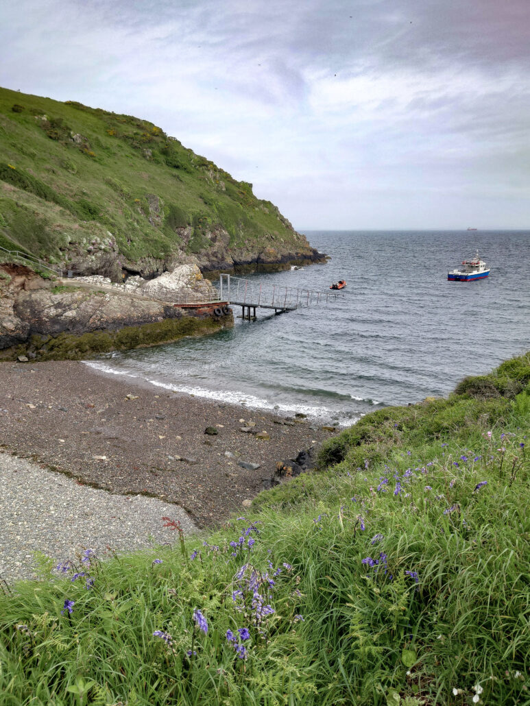
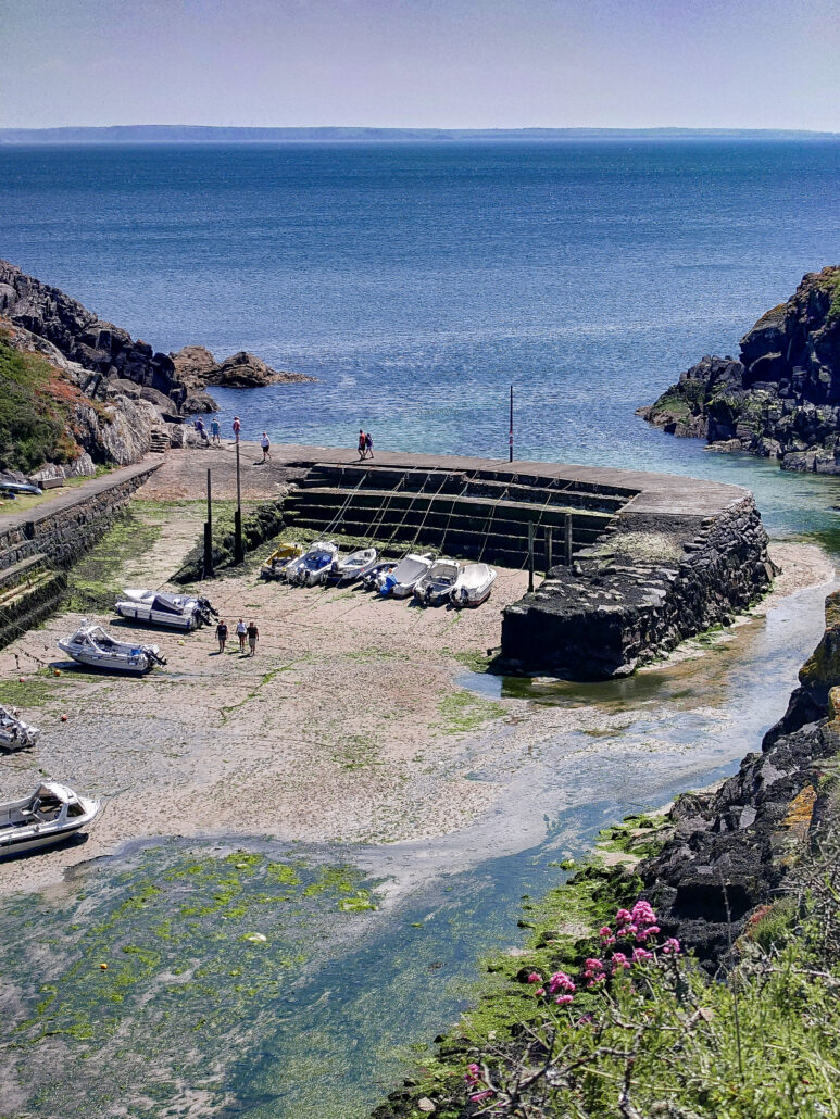
Moving on, Porthclais is next. A sleepy harbour not too far from St David’s. In recent years, places like this have found new life as more people take up kayaking and other water activities.
The path goes on, so do I. It’s been just over 350 miles so far, with 520 miles to go. The path weaves its way around the coast, eventually facing Ramsey Island. Ramsey is the fourth largest Welsh island and this is the point on mainland Wales that is the furthest west.
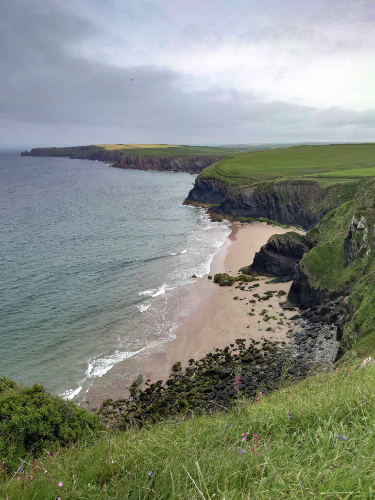
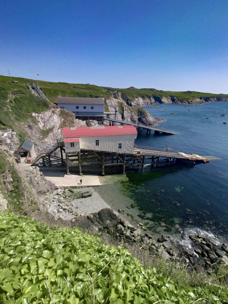
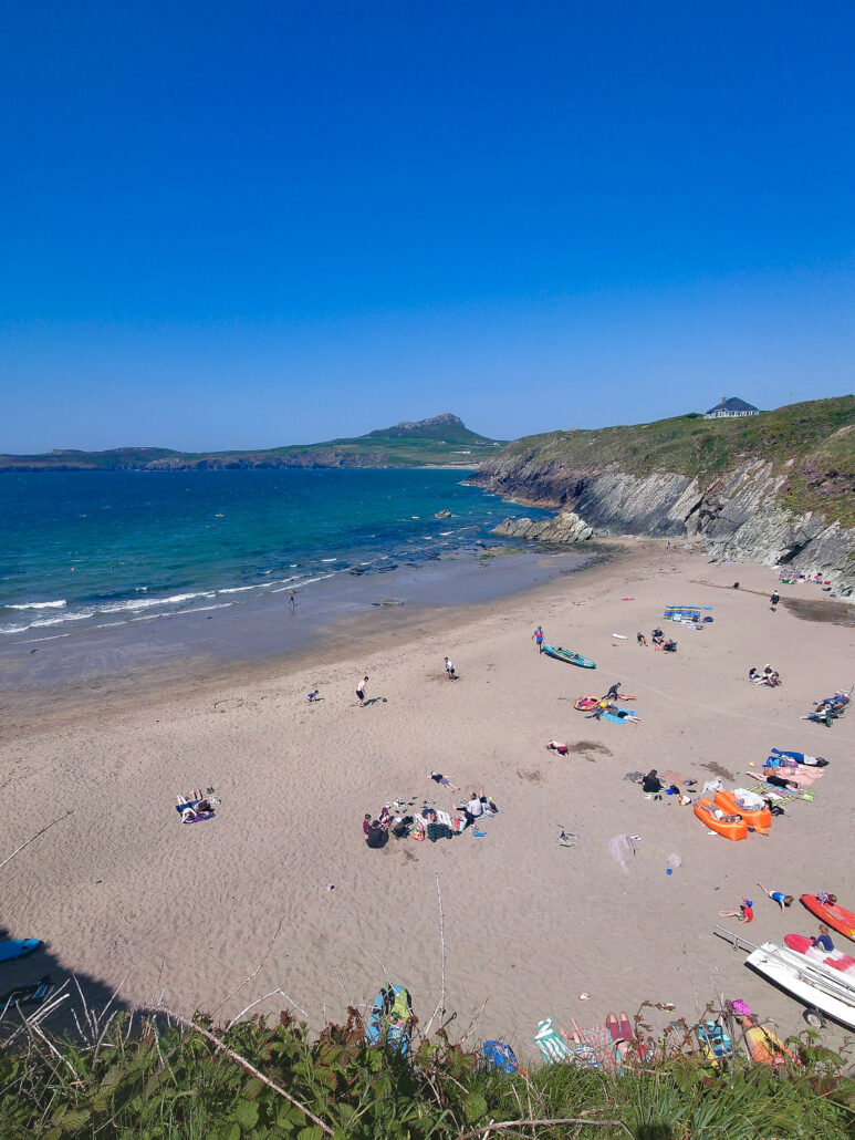
I continue north and east, past St Justinian’s and its lifeboat station, around a headland, and I’m faced with Whitesands Bay. A glorious strip of golden sand and blue water, the gentle hush of the waves as they slip up the beach.
It’s time for an ice cream and a few days off, but I’ll be back to finish Pembrokeshire.
~ ~ ~ ~