Resolven & District Amateur Operatic Society – The Early Years
Below is a photograph of the large Cast, Chorus and Dancers who performed in Franz Lehar’s ‘Gypsy Love’ at the Miners Welfare Hall, Resolven from October 28th to November 1st 1975.
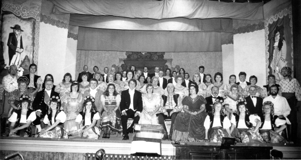
This show proved to be one of the most successful and enjoyable ever performed by Resolven & District Amateur Operatic Society.
That would not have happened if it wasn’t for those people who had the insight and vision to begin the organisation 50 years previously.
The Beginning…
In 1925 (exactly a Century ago) the people in the small village of Resolven, like the rest of the people of Wales and the wider World, were trying hard to edge back to a degree of normality after the trauma, sadness and difficult experiences brought about by the 1914-1918 First World War.
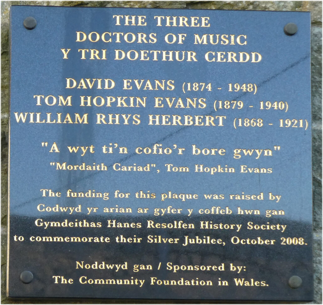
The War Years had obviously taken their toll on the village and there was a longing need for people to start to feel that life could be good again and to participate in leisure and social activities. It was also an exceptional period in the history of Resolven at that time as the people’s interest was heightened by the emergence and presence of Resolven’s Three Doctors of Music, David Evans, Tom Hopkin Evans and William Rhys Herbert who were all prominent and thriving in the village. These three gentleman had created a musical awareness that there was talent in the village that could be nurtured and brought to the forefront for others to enjoy and a developing importance for cultural activities to be performed in the village.
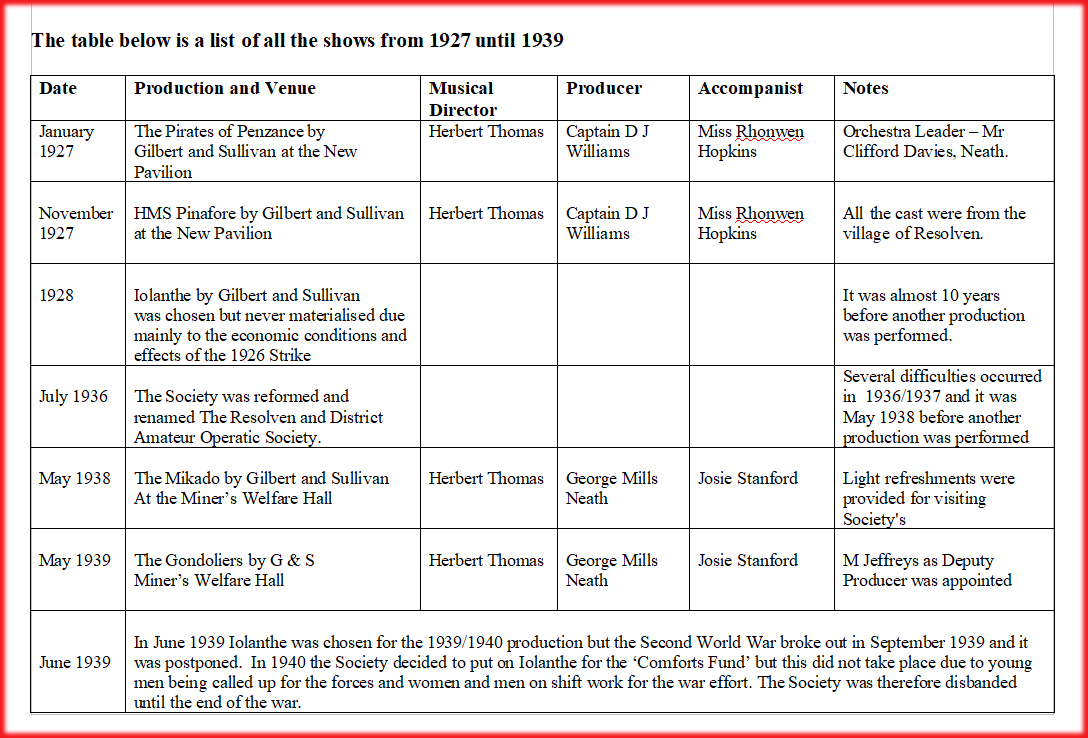
Therefore the idea of forming an operatic society originated in 1925 when the Headmaster, Captain D J Williams of Resolven School who hailed from Ystalyfera, put forward the suggestion to interested parties and soon after a small group of music enthusiasts held several meetings and by 1926 the new Society was launched. The Patron of the new society was Sir Clifford Cory Bart, while its first President was Mr D R Lloyd, M.E.
The Society was named ‘The Resolven Amateur Operatic Society’ and their first production was to be ‘The Pirates of Penzance’ a Gilbert and Sullivan Operetta.
The invited chorus consisted of 7 sopranos, 9 contraltos, 9 tenors and 8 bass. The orchestra was also chosen individually from Resolven and the surrounding area. Most of the cast were chosen from Resolven with the exception of two from Ystalyfera where the Operetta had been performed previously.
Rehearsals commenced with great enthusiasm in Resolven School. There were setbacks and unforeseen happenings as is the usual case for any planned production and a sad death and illness did make an impact on the newly formed Society but ‘The Pirates of Penzance’ did go ahead with replacements from Wednesday 19th to Friday 21st of January 1927. Reserved seats were three shillings and six old pence with unreserved seats at two shillings and four old pence and one shilling and four old pence.
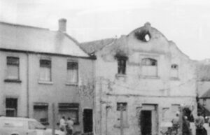
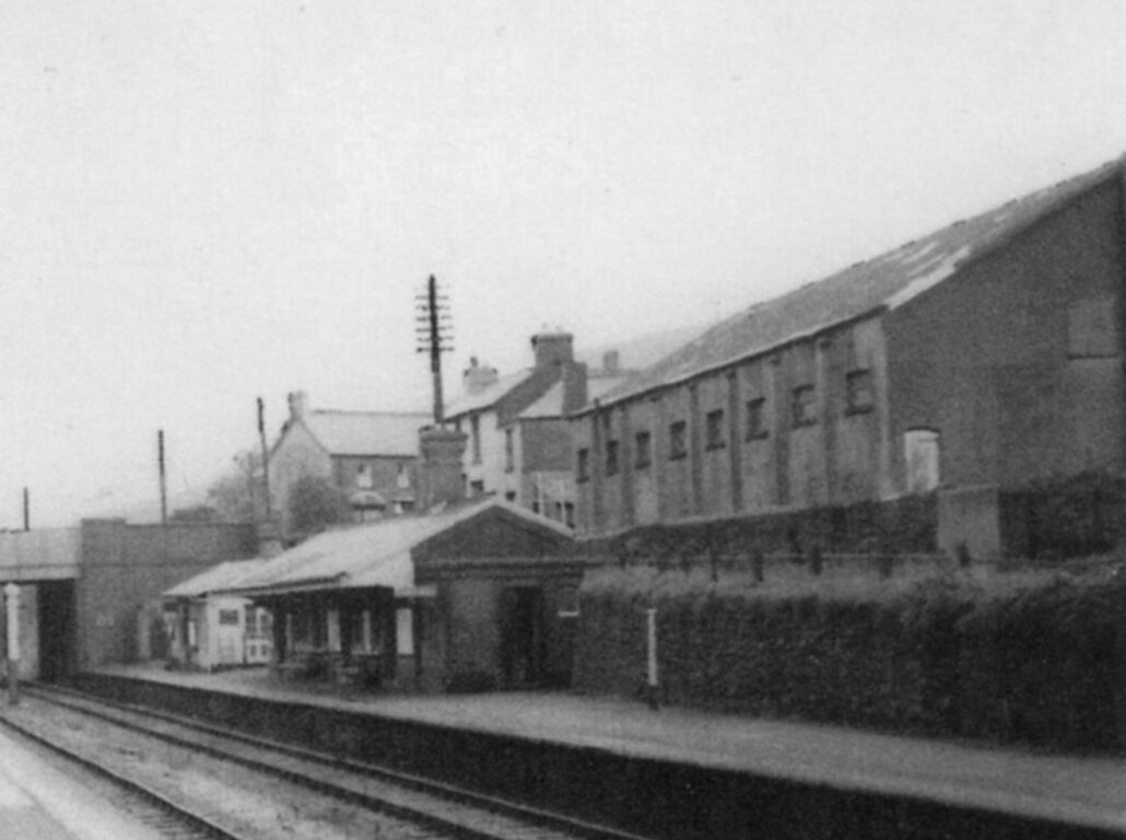
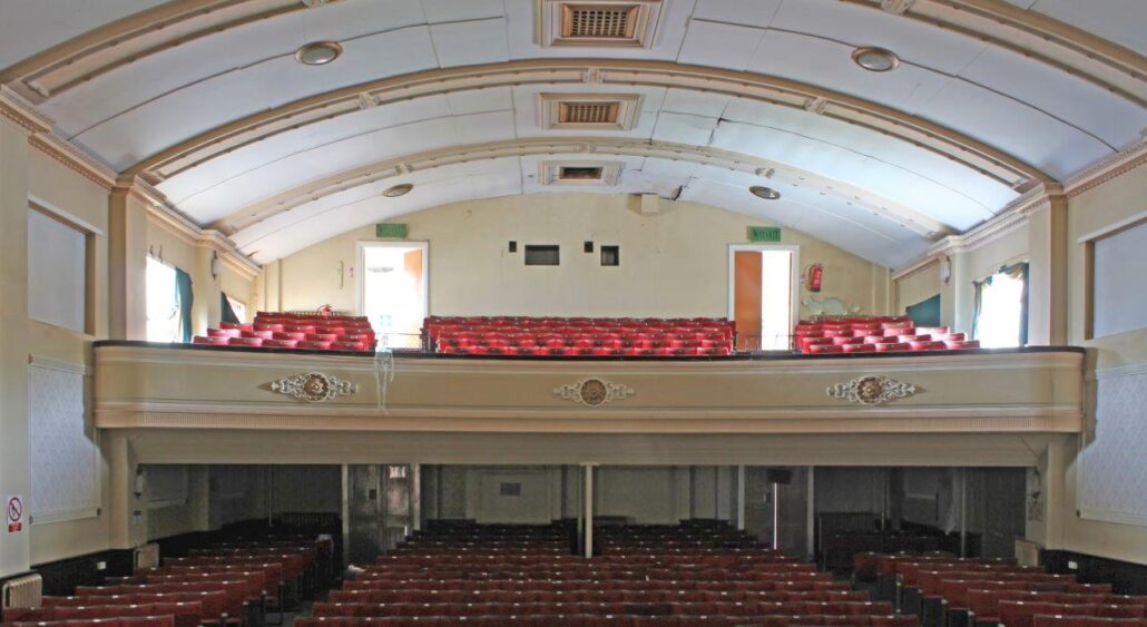
There were three evening performances in the New Pavilion which was situated behind Jerusalem Chapel facing the railway in Williams Avenue. There were no dressing rooms, so the men changed in the Billiard Hall next to the Pavilion owned by DP Williams and the women changed in the houses nearby. Chorus and cast then had to make their way down the back lane to the stage entrance, whatever the weather, sometimes of course in the wind and the rain. There were no back stage facilities and it was no easy task for the Stage Manager and his crew. The scenery and the costumes were both hired.
The first venture of the new Society was a great success and they played to packed houses every night. Such was the enthusiasm shown by keen members involved in the Society that first year, it prompted some members to form the new ‘Resolven Drama Society’ which became very successful in the village and were well thought of throughout Wales for many years.
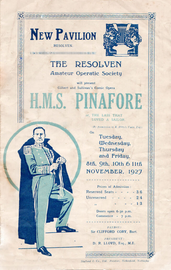
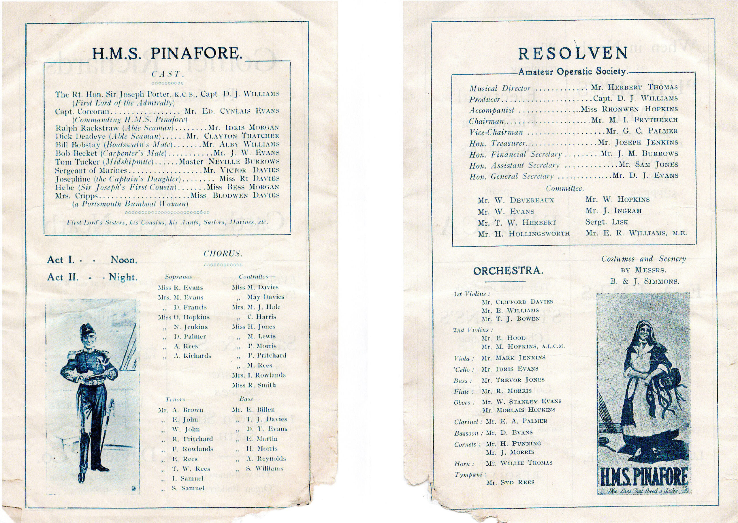
In the same year the Operatic Society did perform a second show ‘HMS Pinafore’ for four performances from Tuesday 8th to Friday 11th November 1927 which was also well attended and enjoyed by the audiences. All the cast were well known characters from the village of Resolven, including Mr Idris Morgan (Father of our RDN Editor, Anita Morgan). Once again the show reached a high standard, but sustained a financial loss, mainly due to the economic conditions at the time as the community was still feeling the effects of the 1926 General Strike.
Gilbert & Sullivan’s ‘Iolanthe’ was chosen for the 1928 production and rehearsals commenced for its performance in October. However, it was never staged, once again probably due to the continuing economic problems and other difficulties at the time.
Regrettably it would be almost ten years before another show would be performed in the village.
It must be remembered that one reason for the delay in the re-forming of the Society might have been that in the early 1930’s a mixed choir was formed in Resolven and it included many of the choristers and members of the Society and every year they gave a concert, as well as joining other societies for various Music Festivals under the leadership of some of the most famous conductors of the time.
During 1935-36 ‘HMS Pinafore’ had successfully been performed in Bethania Chapel, Railway Terrace with Howell Davies as conductor. This proved to be such a resounding success that, after several meetings, the decision was made to re-start the Resolven Amateur Operatic Society.
The Society at this stage was gaining a reputation for itself, its popularity had spread, due to newspaper cuttings and word of mouth, creating interest from other musically talented men and women in the surrounding areas, who were very keen to be part of this newly formed and exciting venture. Therefore, a meeting was called to discuss this valid issue to try to ensure that all the performers on the Welfare Stage would be recognised and appreciated from their own particular areas.
A general meeting was called on July 8th 1936, at the Vivian Hall and it was decided that the Society should be re-formed and renamed the ‘Resolven and District Amateur Operatic Society‘, and at a subsequent meeting on July 14th all the Officers and Committee of the Society were chosen. Mrs Mary Jenkins of the Vaughan Arms was chosen as President of the newly named Society.
The Committee were kept busy arranging social evenings and dances for friends and members to raise funds, including a Coronation dance in 1937 in the Vivian Hall, which was situated in the centre of the village near the railway station, behind the Vaughan Arms. It is also an interesting fact that for the first time, letterheads were printed with the Society’s name on them.
The number of invited choristers remained the same as before and a list of probable guarantors or patrons of the Society were drawn up.
‘The Mikado’ was chosen for the first production of the re-formed society but a number of difficulties delayed the production, with poor attendance at rehearsals and Mr Howell Davies, gave up the post of Musical Director when he left the village in 1938, so Mr Herbert Thomas took up the baton.
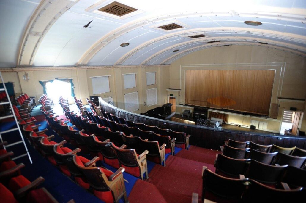
In January of 1938, a decision was made to perform the Mikado in the new and impressively built Miners’ Welfare Hall.
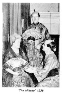
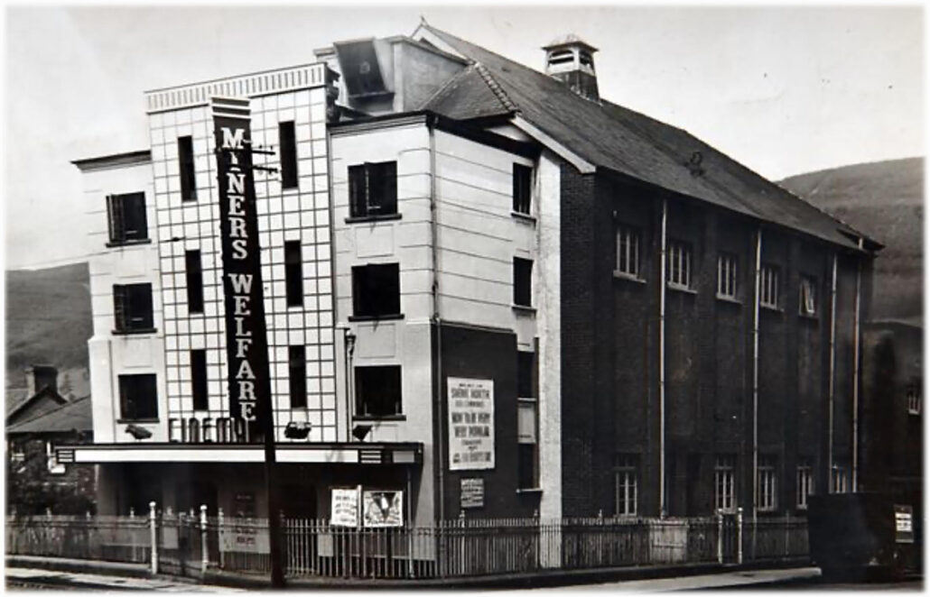
Four performances of the Mikado took place from Thursday 17th May to Saturday 21st May 1938. The Tuesday night’s performance was for Old Age Pensioners, the unemployed and children. Adults were charged one shilling and children six old pence. Light refreshments were provided for the company after each performance and also any visiting societies.
The Society at this time became guarantors for £10 to the Mayor of Swansea’s appeal for the Sadler’s Wells Opera Company who regularly performed Gilbert and Sullivan Operettas.
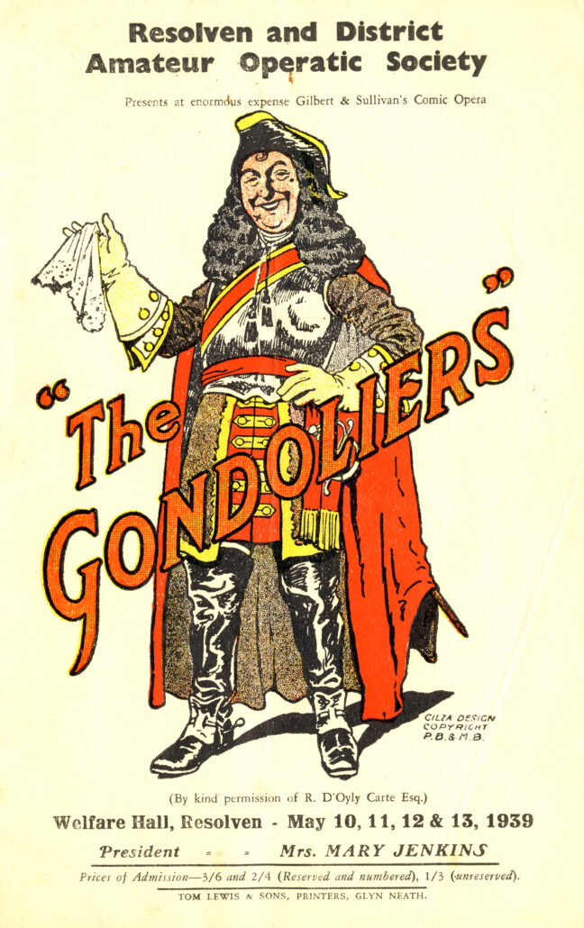
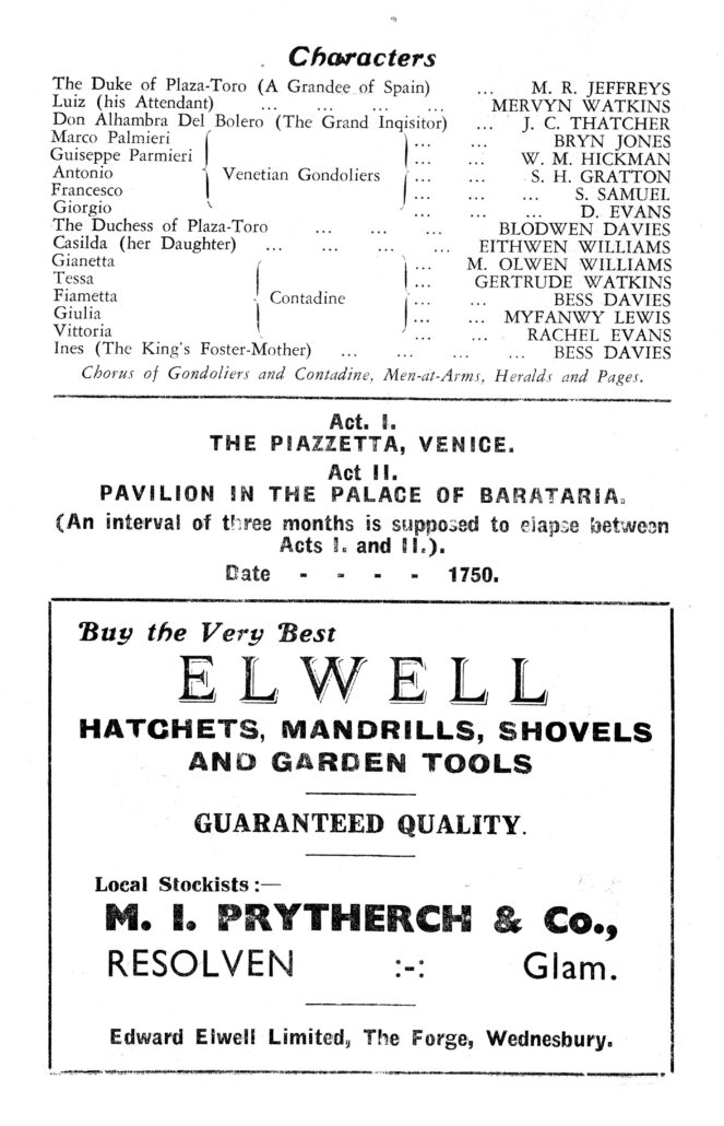
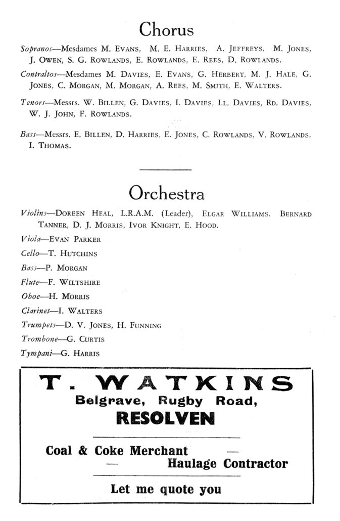
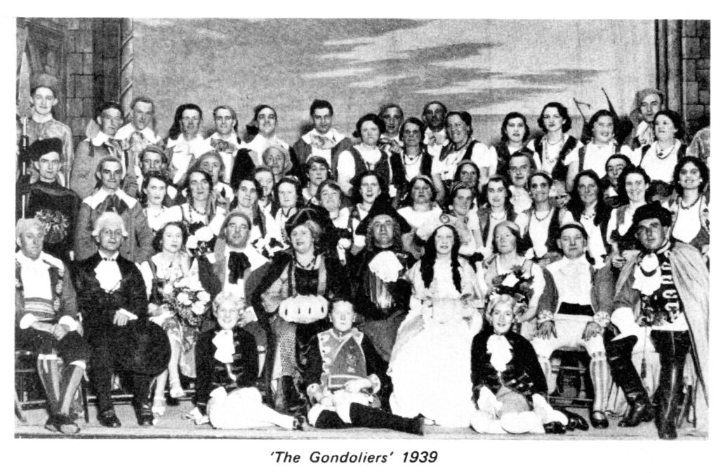
On September 22nd of 1938, practices re-commenced for the next production, The Gondoliers which took place from Wednesday May 10th to Saturday May 13th 1939. During the dress rehearsal on the Tuesday, children were allowed into the Welfare Hall, at a charge of six old pence upstairs and three old pence downstairs.
The following are some of the pages from the programme.
~
~
~
~
~
Iolanthe was chosen as the next production for the 1939/1940 season, rehearsals commencing on September 28th 1939. As the war had broken out on September 3rd 1939, it was decided in October to postpone the production at that time.
In Spring 1940, the Society decided to put on Iolanthe for the Comfort’s Fund. Defaulting members were informed and rehearsals resumed in March, with a view to performances in May 1940.
Sadly Iolanthe proved, once again, an unlucky show for the society,, with young men being called up to serve in the armed forces, and both men and women on shift-work for the war effort, the show had to be abandoned and the Society disbanded until the end of the War.
~ ~
Some information taken from ‘Resolven Operatic Society’ – ‘A History from 1925 ~ 1976’ by Nesta Hopkins with additional information from Owen & Christine Davies. Compiled by Lorna & Hugh Lewis.
~
To be continued…………..